MyTopo
Heafer Arkansas US Topo Map
Couldn't load pickup availability
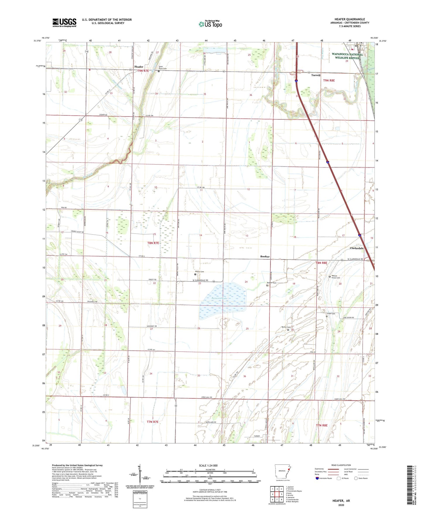
2024 topographic map quadrangle Heafer in the state of Arkansas. Scale: 1:24000. Based on the newly updated USGS 7.5' US Topo map series, this map is in the following counties: Crittenden. The map contains contour data, water features, and other items you are used to seeing on USGS maps, but also has updated roads and other features. This is the next generation of topographic maps. Printed on high-quality waterproof paper with UV fade-resistant inks.
Quads adjacent to this one:
West: Earle
Northwest: Joyland
North: Tyronza
Northeast: Frenchmans Bayou
East: Jericho
Southeast: West Memphis
South: Crawfordsville
Southwest: Jeanette
This map covers the same area as the classic USGS quad with code o35090c3.
Contains the following named places: Abston Wynne School, Bell School, Benwood Lake, Billow Cemetery, Booker, Booker Cemetery, Booker School, Brown Cemetery, Butler Church, Carruth School, Cruse Cemetery, Deer Bayou, Ditch Number 1, Ditch Number 10, Ditch Number 11, Ditch Number 2, Ditch Number 21, Ditch Number 32, Ditch Number 4, Ditch Number 6, Ditch Number 7, Ditch Number 8, East Black Oak, Galilee Church, Heafer, Heafer East Black Oak Volunteer Fire Department, Lencross Church, Macedonia Church, Mount Vernon Church, New Bethel Church, New Bethlehem Church, New Bethlehem School, New Mount Pisgah Church, Patterson School, Philadelphia Church, Saint Pauls Cemetery, Saint Pauls Church, Township of Wappanocca, Turrell Post Office, Turrell Volunteer Fire Department, United States Fish and Wildlife Wapanocca National Wildlife Refuge Park Security, Walnut Grove Cemetery, Walnut Grove Church