MyTopo
Earle Arkansas US Topo Map
Couldn't load pickup availability
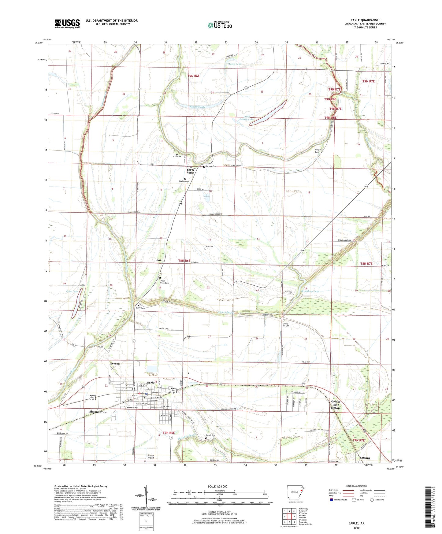
2024 topographic map quadrangle Earle in the state of Arkansas. Scale: 1:24000. Based on the newly updated USGS 7.5' US Topo map series, this map is in the following counties: Crittenden. The map contains contour data, water features, and other items you are used to seeing on USGS maps, but also has updated roads and other features. This is the next generation of topographic maps. Printed on high-quality waterproof paper with UV fade-resistant inks.
Quads adjacent to this one:
West: Parkin
Northwest: Monterey
North: Joyland
Northeast: Tyronza
East: Heafer
Southeast: Crawfordsville
South: Jeanette
Southwest: Gieseck
This map covers the same area as the classic USGS quad with code o35090c4.
Contains the following named places: Barton Chapel, Beautiful Lake, Berry Cemetery, Big Creek, Big Lake, Black Oak Church, Brougham Lake, Cane Lake, City of Earle, Cloar, Cloar Cemetery, Ditch Number 1, Ditch Number 13, Ditch Number 22, Ditch Number 9, Dunbar Elementary School, Dunbar High School, Dunbar Middle School, Earle, Earle Elementary School, Earle Emergency Ambulance, Earle Fire Station, Earle High School, Earle Middle School, Earle Police Department, Earle Post Office, Gibson Bayou, Gibson Bayou Cemetery, Gibson Bayou Church, Grassy Lake Bottom, Hood Cemetery, Hood Lake, Lansing, Layton Cemetery, Lewis Lake, Little Grassy Lake, New Prosperity Church, Norvell, Pilgrims Rest Church, Poindexter, Prosperity Cemetery, Prosperity School, Richard Cemetery, Russell Cemetery, Saint Peter School, Saint Peters Church, Shannonville, Spring Hill Cemetery, Spring Hill Church, Stump Lake, Three Forks, Tupelo Brake, ZIP Code: 72331