MyTopo
Frenchmans Bayou Arkansas US Topo Map
Couldn't load pickup availability
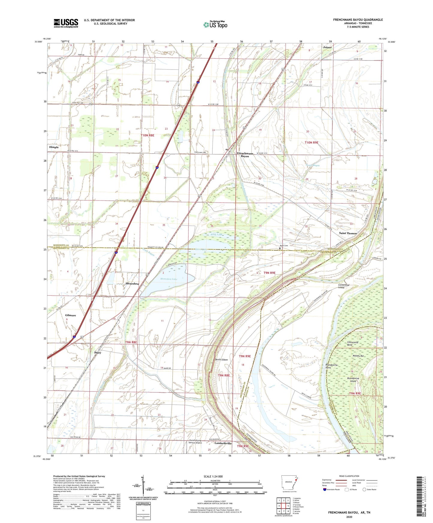
2024 topographic map quadrangle Frenchmans Bayou in the states of Arkansas, Tennessee. Scale: 1:24000. Based on the newly updated USGS 7.5' US Topo map series, this map is in the following counties: Mississippi, Crittenden, Tipton. The map contains contour data, water features, and other items you are used to seeing on USGS maps, but also has updated roads and other features. This is the next generation of topographic maps. Printed on high-quality waterproof paper with UV fade-resistant inks.
Quads adjacent to this one:
West: Tyronza
Northwest: Lepanto
North: Joiner
Northeast: Wilson
East: Pecan Point
Southeast: Locke
South: Jericho
Southwest: Heafer
Contains the following named places: Barney Chute, Bellhammer Slough, Brandywine Chute, Brandywine Point, Centennial Bend, Centennial Island, Chapman Switch, Chute 38, Devils Elbow, Ditch Number 1, Ditch Number 11, Ditch Number 14, Ditch Number 15, Ditch Number 2, Ditch Number 3, Ditch Number 4, Frenchmans Bayou, Frenchmans Bayou Post Office, Happy Valley Landing, Happy Valley Revetment, KPYR-FM (Osceola), Lake Grove Church, Lambethville, Massey Bar, McKenzie Chute, Meneshea, Meneshea Lake, Meneshea School, Mink Lake, Mount Zion Church, Peach Bayou, Rasts Landing, Rupe Cemetery, Saint Francis Levee, Saint Pauls Church, Saint Thomas, Saint Thomas Church, Sam Barr Lake, Shawnee Elementary School, Sims, Stacy, Stave Lake, Swan Lake, Township of Fogleman, Township of McGavock, Township of Old River, Turrell Flying Service Airport, Union Grove Church, Willow Lake, ZIP Codes: 72338, 72350, 72384