MyTopo
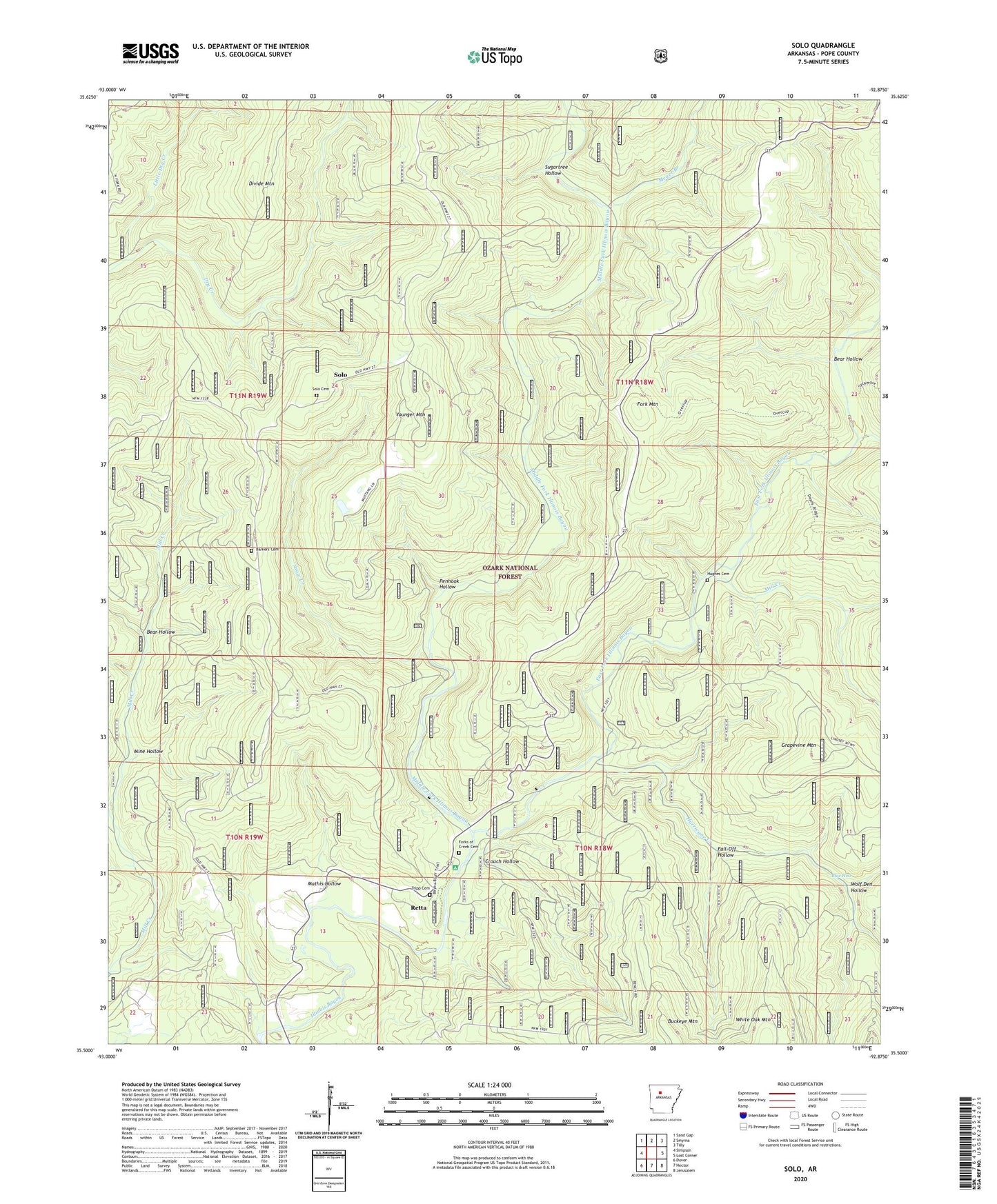
Solo Arkansas US Topo Map
Couldn't load pickup availability
Also explore the Solo Forest Service Topo of this same quad for updated USFS data
2024 topographic map quadrangle Solo in the state of Arkansas. Scale: 1:24000. Based on the newly updated USGS 7.5' US Topo map series, this map is in the following counties: Pope. The map contains contour data, water features, and other items you are used to seeing on USGS maps, but also has updated roads and other features. This is the next generation of topographic maps. Printed on high-quality waterproof paper with UV fade-resistant inks.
Quads adjacent to this one:
West: Simpson
Northwest: Sand Gap
North: Smyrna
Northeast: Tilly
East: Lost Corner
Southeast: Jerusalem
South: Hector
Southwest: Dover
This map covers the same area as the classic USGS quad with code o35092e8.
Contains the following named places: Atkins School, Barkers Cemetery, Bayou Bluff Camp, Bayou Bluff Recreation Area, Bear Hollow, Blue Hole, Buckeye Mountain, Crouch Hollow, Divide Mountain, East Fork Illinois Bayou, Fall-Off Hollow, Fork Mountain, Forks of Creek Cemetery, Gabriel, Grapevine Mountain, Hughes Cemetery, Hurricane Creek, Little Dry Creek, Mathis Hollow, Meyer Branch, Middle Fork Illinois Bayou, Mill Creek, Mine Hollow, Mount Liberty School, Penhook Hollow, Retta, Snow Creek, Solo, Solo Cemetery, Sugartree Hollow, Sycamore Creek, Township of Independence, Township of Jackson, Tripp Cemetery, Union Hill School, Wolf Den Hollow, Younger Mountain, ZIP Code: 72843