MyTopo
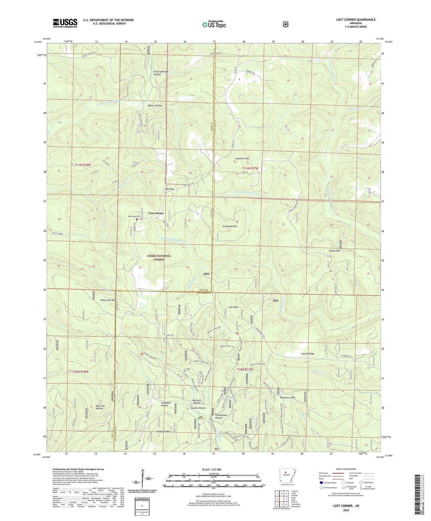
Lost Corner Arkansas US Topo Map
Couldn't load pickup availability
Also explore the Lost Corner Forest Service Topo of this same quad for updated USFS data
2024 topographic map quadrangle Lost Corner in the state of Arkansas. Scale: 1:24000. Based on the newly updated USGS 7.5' US Topo map series, this map is in the following counties: Van Buren, Pope. The map contains contour data, water features, and other items you are used to seeing on USGS maps, but also has updated roads and other features. This is the next generation of topographic maps. Printed on high-quality waterproof paper with UV fade-resistant inks.
Quads adjacent to this one:
West: Solo
Northwest: Smyrna
North: Tilly
Northeast: Alread
East: Rex
Southeast: Cleveland
South: Jerusalem
Southwest: Hector
This map covers the same area as the classic USGS quad with code o35092e7.
Contains the following named places: Armstead Mountain, Austin, Austin Ridge, Austin School, Campbell Hollow, Dry Creek, East Fork Wilderness, Hatley Mountain, John Mountain, Kincannon Mountain, Koones Gulf, Lost Corner, Moccasin Hollow, Napier Hollow, New Hope Cemetery, New Hope School, North Prong Brushy Fork, Northwood, Oak Mountain, Okay, Schoolhouse Hollow, Snowlick Mountain, Stoebuck Mountain, Sweden Hollow, Township of Hill, Township of White Oak, Victor Millsaps Hollow, West Prong Brushy Fork, Wilson Creek