MyTopo
Leachville Arkansas US Topo Map
Couldn't load pickup availability
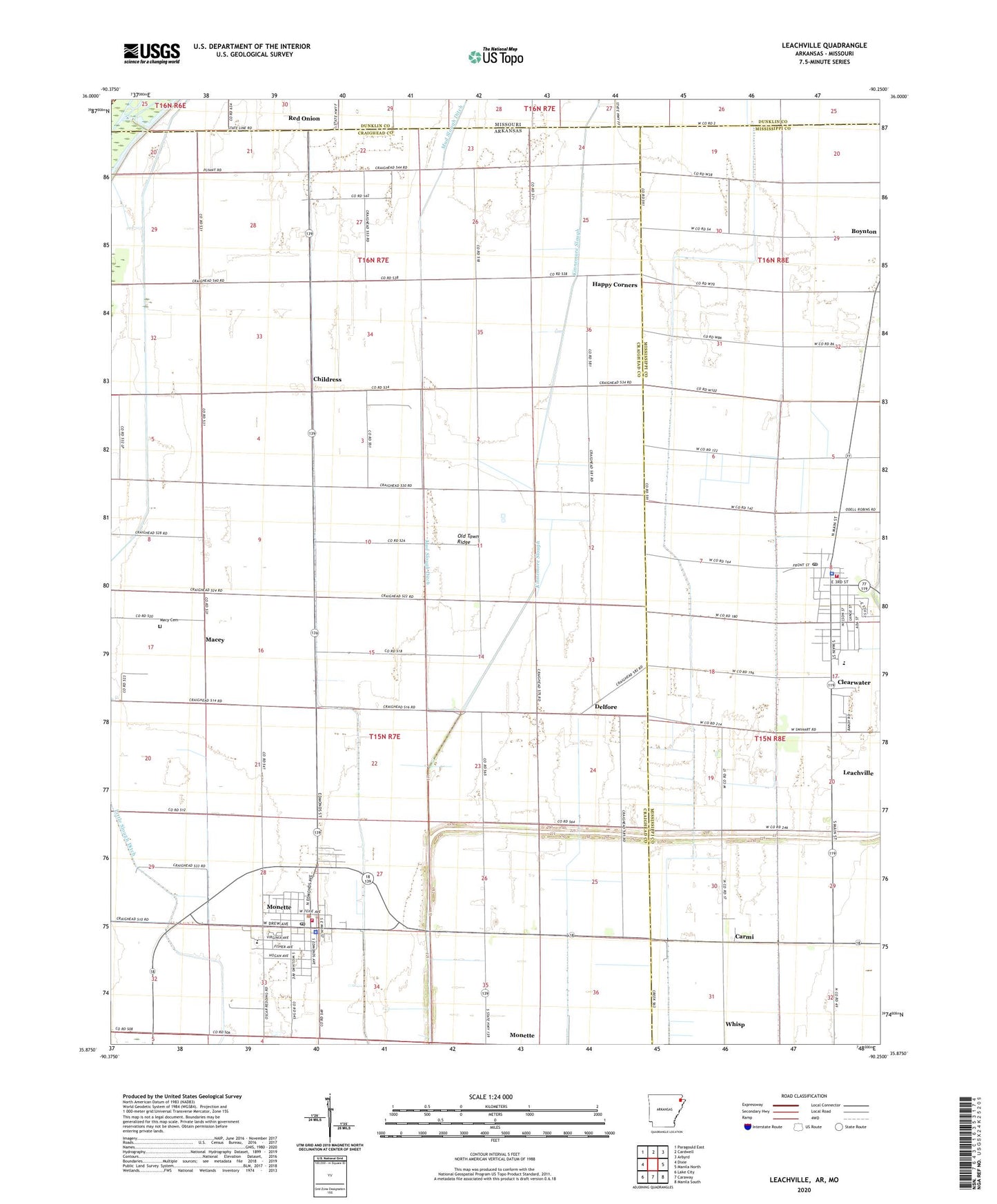
2024 topographic map quadrangle Leachville in the states of Arkansas, Missouri. Scale: 1:24000. Based on the newly updated USGS 7.5' US Topo map series, this map is in the following counties: Craighead, Mississippi, Dunklin, Greene. The map contains contour data, water features, and other items you are used to seeing on USGS maps, but also has updated roads and other features. This is the next generation of topographic maps. Printed on high-quality waterproof paper with UV fade-resistant inks.
Quads adjacent to this one:
West: Dixie
Northwest: Paragould East
North: Cardwell
Northeast: Arbyrd
East: Manila North
Southeast: Manila South
South: Caraway
Southwest: Lake City
Contains the following named places: Buffalo Island Central East Elementary School, Buffalo Island Central High School, Buffalo Island Central Junior High School, Buffalo Island Central West Elementary School, Buffalo Island Emergency Medical Services, Carmi, Childress, City of Leachville, City of Monette, Clearwater, Delfore, Happy Corner Church, Happy Corners, Kingdom Hall, Kinnemore Slough, KXXA-AM (Monette), Leachville, Leachville Police Department, Leachville Post Office, Leachville Volunteer Fire Department, Little Ditch Number 3, Macey, Macey School, Macy Cemetery, Macy Church, Monette, Monette Police Department, Monette Post Office, Monette Volunteer Fire Department, Mud Slough Ditch, Old Town Ridge, Orr, Price Landing Strip, Red Onion, Springfield, Township of Buffalo, Turkey Run School, Upper Macey School, Whisp, Whited Brothers Landing Strip, ZIP Code: 72447