MyTopo
Manila North Arkansas US Topo Map
Couldn't load pickup availability
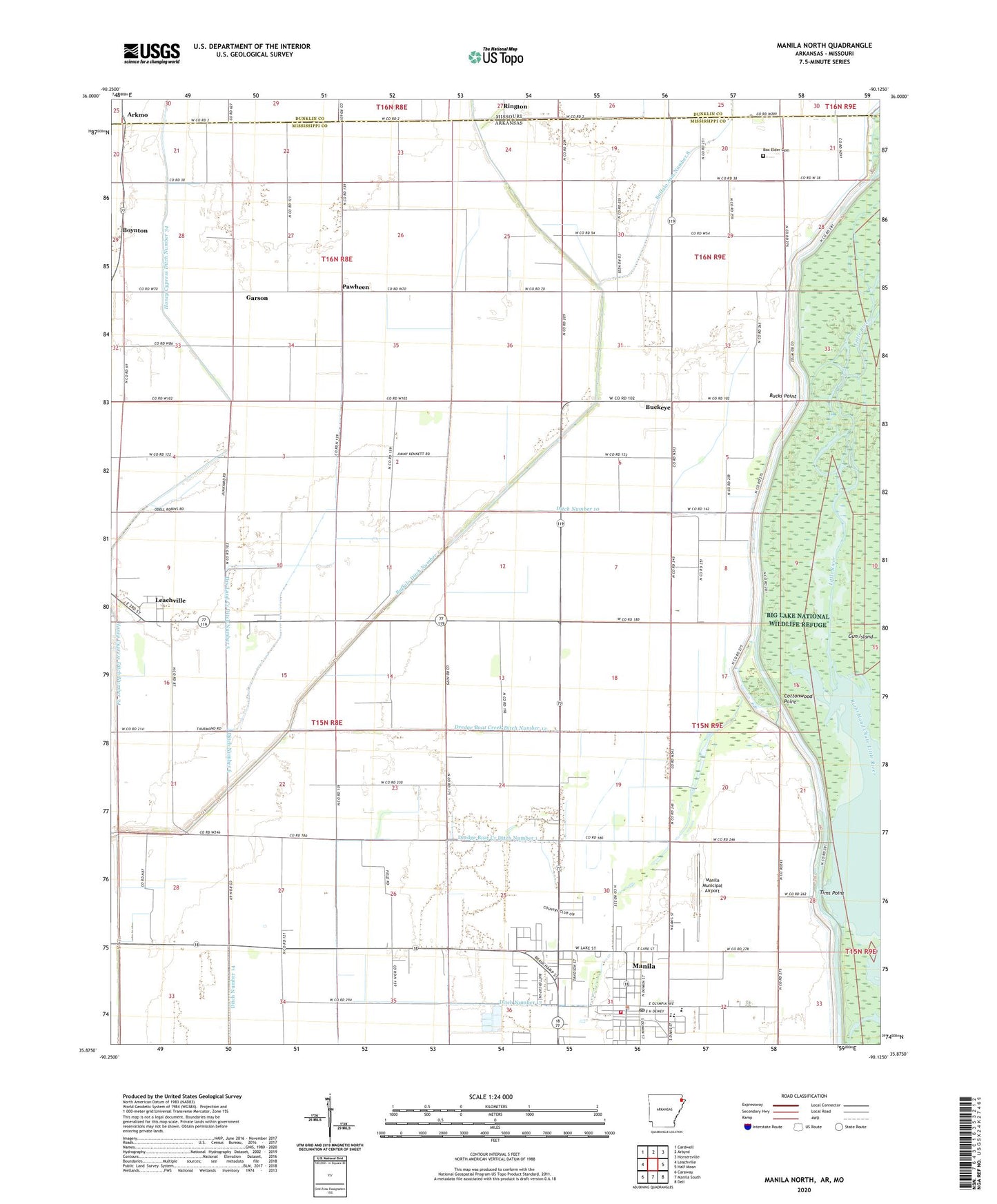
2024 topographic map quadrangle Manila North in the states of Arkansas, Missouri. Scale: 1:24000. Based on the newly updated USGS 7.5' US Topo map series, this map is in the following counties: Mississippi, Dunklin. The map contains contour data, water features, and other items you are used to seeing on USGS maps, but also has updated roads and other features. This is the next generation of topographic maps. Printed on high-quality waterproof paper with UV fade-resistant inks.
Quads adjacent to this one:
West: Leachville
Northwest: Cardwell
North: Arbyrd
Northeast: Hornersville
East: Half Moon
Southeast: Dell
South: Manila South
Southwest: Caraway
Contains the following named places: Arkmo, Bethany Baptist Church, Box Elder, Box Elder Cemetery, Box Elder School, Boxelder Church, Boynton, Boynton School, Brown, Brown School, Browns Chapel Baptist Church, Buckeye, Bucks Point, Buffalo Arm Number 8, Buffalo Ditch Number 1, Buffalo Island Community Hospital, Church of Christ, City of Manila, Cottonwood Point, Ditch Number 10, Ditch Number 14, Ditch Number 16, Ditch Number 17, Ditch Number 6, Dredge Boat Creek Ditch Number 1, Dredge Boat Creek Ditch Number 12, Dry Land Creek Ditch Number 5, Emerson Ambulance Service Manila, First Baptist Church of Manila, Garson, Hills Store, Hone Cypress Ditch Number 2, Honey Cypress Swamp, Jolliff Store, Justin Veach Elementary School, Little River, Manila, Manila Fire Department, Manila High School, Manila Municipal Airport, Manila Police Department, Manila Post Office, New Hope Church, New Hope School, New Providence Baptist Church, Pawheen, Pawheen School, Poplar Corner, Rington, Skidway Church, Skidway School, Spur Number 4, Tims Point, Township of Neal, Union Band Church, Westside Baptist Church, Westside Church, ZIP Code: 72438