MyTopo
Caraway Arkansas US Topo Map
Couldn't load pickup availability
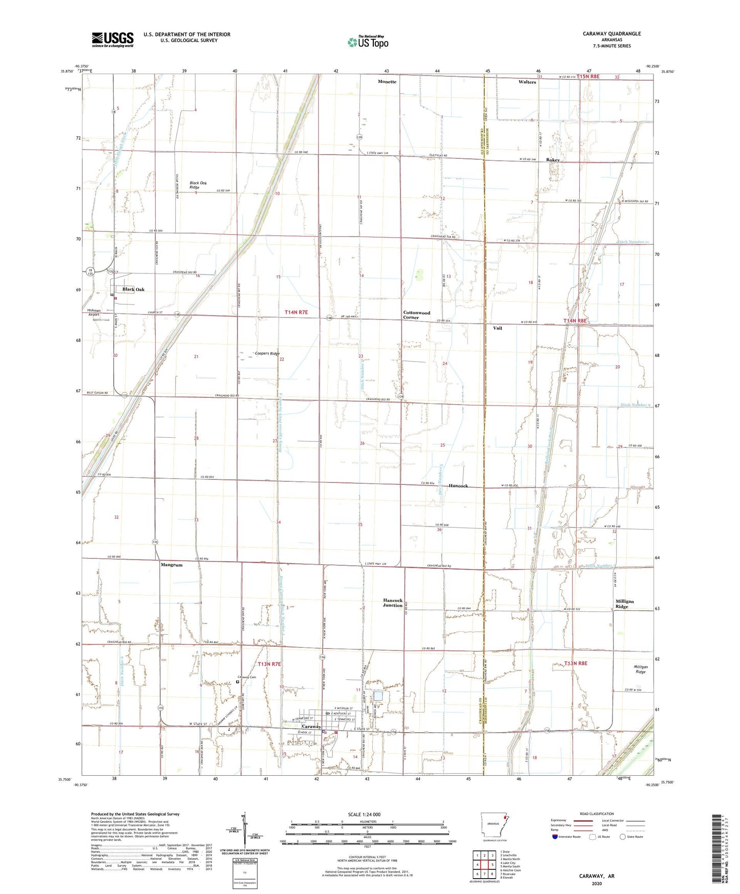
2024 topographic map quadrangle Caraway in the state of Arkansas. Scale: 1:24000. Based on the newly updated USGS 7.5' US Topo map series, this map is in the following counties: Craighead, Mississippi. The map contains contour data, water features, and other items you are used to seeing on USGS maps, but also has updated roads and other features. This is the next generation of topographic maps. Printed on high-quality waterproof paper with UV fade-resistant inks.
Quads adjacent to this one:
West: Lake City
Northwest: Dixie
North: Leachville
Northeast: Manila North
East: Manila South
Southeast: Etowah
South: Rivervale
Southwest: Hatchie Coon
This map covers the same area as the classic USGS quad with code o35090g3.
Contains the following named places: Asher Ditch, Black Oak, Black Oak Post Office, Black Oak Ridge, Black Oak School, Black Oak Volunteer Fire Department, Caraway, Caraway Cemetery, Caraway Police Department, Caraway Post Office, Caraway Volunteer Ambulance Service, Caraway Volunteer Fire Department, Chicago Mill, City of Caraway, Cockle Burr Slough Ditch, Coopers Ridge, Cottonwood Corner, Ditch Number 5, Ditch Number 6, Hancock, Hancock Junction, Hancock School, Hickman Airport, Honey Cypress Ditch Number 4, Little Slough Ditch, Mangrum, Mangrum School, Milligan Ridge, Milligan Ridge Church, Milligan Ridge School, Mount Pleasant Church, Mulligans Camp, Riverside East Elementary School, Riverside Junior High School, Rokey, Rowes Chapel Baptist Church, Swift Point Overflow, Town of Black Oak, Township of Black Oak, Upper Mangrum School, Vail, Wallace School, Walters, ZIP Code: 72414