MyTopo
Lepanto Arkansas US Topo Map
Couldn't load pickup availability
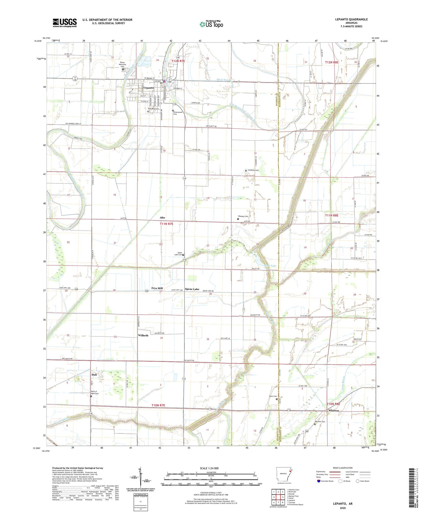
2024 topographic map quadrangle Lepanto in the state of Arkansas. Scale: 1:24000. Based on the newly updated USGS 7.5' US Topo map series, this map is in the following counties: Poinsett, Mississippi. The map contains contour data, water features, and other items you are used to seeing on USGS maps, but also has updated roads and other features. This is the next generation of topographic maps. Printed on high-quality waterproof paper with UV fade-resistant inks.
Quads adjacent to this one:
West: Marked Tree
Northwest: Hatchie Coon
North: Rivervale
Northeast: Etowah
East: Joiner
Southeast: Frenchmans Bayou
South: Tyronza
Southwest: Joyland
This map covers the same area as the classic USGS quad with code o35090e3.
Contains the following named places: Alto, Browns Lake, Church of God, City of Lepanto, Conaster Cemetery, Ditch Number 39, Ditch Number 40, Ditch Number 45a, Ditch Number 45b, Ditch Number 47, Ditch Number 47a, Ditch Number 48, Ditch Number 49, Ditch Number 50, Ditch Number 51, Ditch Number 51b, Ditch Number 6, Ditch Number 68, Ditch Number 69, Ditch Number 72, Dub, Dunn Cemetery, East Poinsett County Elementary School, East Poinsett County High School, Emery Chapel, Frys Mill, Greenwood Cemetery, Greenwood School, Helm Landing Strip, Kerr School, Lepanto, Lepanto Elementary School, Lepanto Police Department, Lepanto Post Office, Lepanto Volunteer Fire Department, Pentecostal Church, Pine Rest Cemetery, Potter Memorial Cemetery, Price Field, Rock of Ages Cemetery, Rock of Ages Church, Sky Lake, Spear Lake, Spear Lake Cemetery, Spear Lake School, Tupelo Lake, Ward Cemetery, Whitton, Whitton Baptist Church, Whitton Cemetery, Whitton Church, Whitton School, Wilbeth, Woolsey Cemetery, ZIP Code: 72354