MyTopo
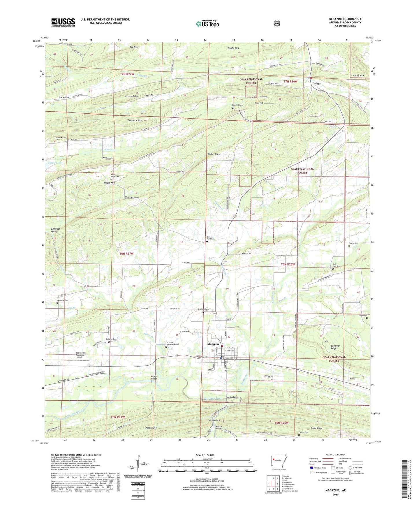
Magazine Arkansas US Topo Map
Couldn't load pickup availability
Also explore the Magazine Forest Service Topo of this same quad for updated USFS data
2024 topographic map quadrangle Magazine in the state of Arkansas. Scale: 1:24000. Based on the newly updated USGS 7.5' US Topo map series, this map is in the following counties: Logan. The map contains contour data, water features, and other items you are used to seeing on USGS maps, but also has updated roads and other features. This is the next generation of topographic maps. Printed on high-quality waterproof paper with UV fade-resistant inks.
Quads adjacent to this one:
West: Booneville
Northwest: Branch
North: Caulksville
Northeast: Paris
East: Blue Mountain
Southeast: Blue Mountain Dam
South: Sugar Grove
Southwest: Golden City
This map covers the same area as the classic USGS quad with code o35093b7.
Contains the following named places: Backbone Mountain, Barn Hill, Barn Hill Cemetery, Barn Hill Church, Bee Mountain, Bluff View Cemetery, Booneville Municipal Airport, Briar Creek, Callahan Cemetery, Catlett Cemetery, Cauthron, Cauthron Church, Center Point Cemetery, Center Point Church, Chigger Creek, City of Magazine, Clarks Church, Crocker Creek, Driggs, Driggs Rural Fire Department, Ellington Cemetery, Evans Cemetery, First Bridge, Fletcher Branch, Gin Branch, Hickory Ridge, Kilburn Bridge, Landmark Cemetery, Logan County Emergency Medical Service - Booneville, Magazine, Magazine City Volunteer Fire Department, Magazine Elementary School, Magazine Gas Field, Magazine High School, Magazine Police Department, Magazine Post Office, Memorial Cemetery, Middle Bridge, Mount Nebo Church, Mount Pisgah Cemetery, Mount Pisgah School, Old Union-Cumberland Cemetery, Pisgah Mountain, Pleasant Hill, Pleasant Hill School, Prairie Branch, Prospect Church, Revilee, Revilee Church, Revilee Creek, Scotts Creek, Sexton Cemetery, The Narrows, Township of Driggs, Township of Reveilee, Turkey Ridge, Wesley Chapel, Wesson-Davis Field, Whiteoak Valley, ZIP Code: 72943