MyTopo
McArthur Arkansas US Topo Map
Couldn't load pickup availability
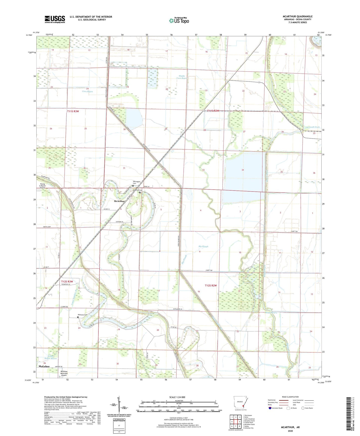
2024 topographic map quadrangle McArthur in the state of Arkansas. Scale: 1:24000. Based on the newly updated USGS 7.5' US Topo map series, this map is in the following counties: Desha. The map contains contour data, water features, and other items you are used to seeing on USGS maps, but also has updated roads and other features. This is the next generation of topographic maps. Printed on high-quality waterproof paper with UV fade-resistant inks.
Quads adjacent to this one:
West: McGehee North
Northwest: Winchester
North: Kelso
Northeast: Lake Cheatham
East: Catfish Point
Southeast: Arkansas City
South: Halley
Southwest: McGehee South
This map covers the same area as the classic USGS quad with code o33091f3.
Contains the following named places: Big Slough, Boggy Bayou, Bogota, Canal Number 16, Canal Number 43, Lake Isaacs, Macedonia Church, McArthur, McArthur Cemetery, McArthurs Friends Church, Middle Coon Bayou, Mount Zion Church, Opossum Fork, Palestine Cemetery, Palestine Church, Sims Chapel, Township of Clayton, Warrington Cemetery, Wolff Project School