MyTopo
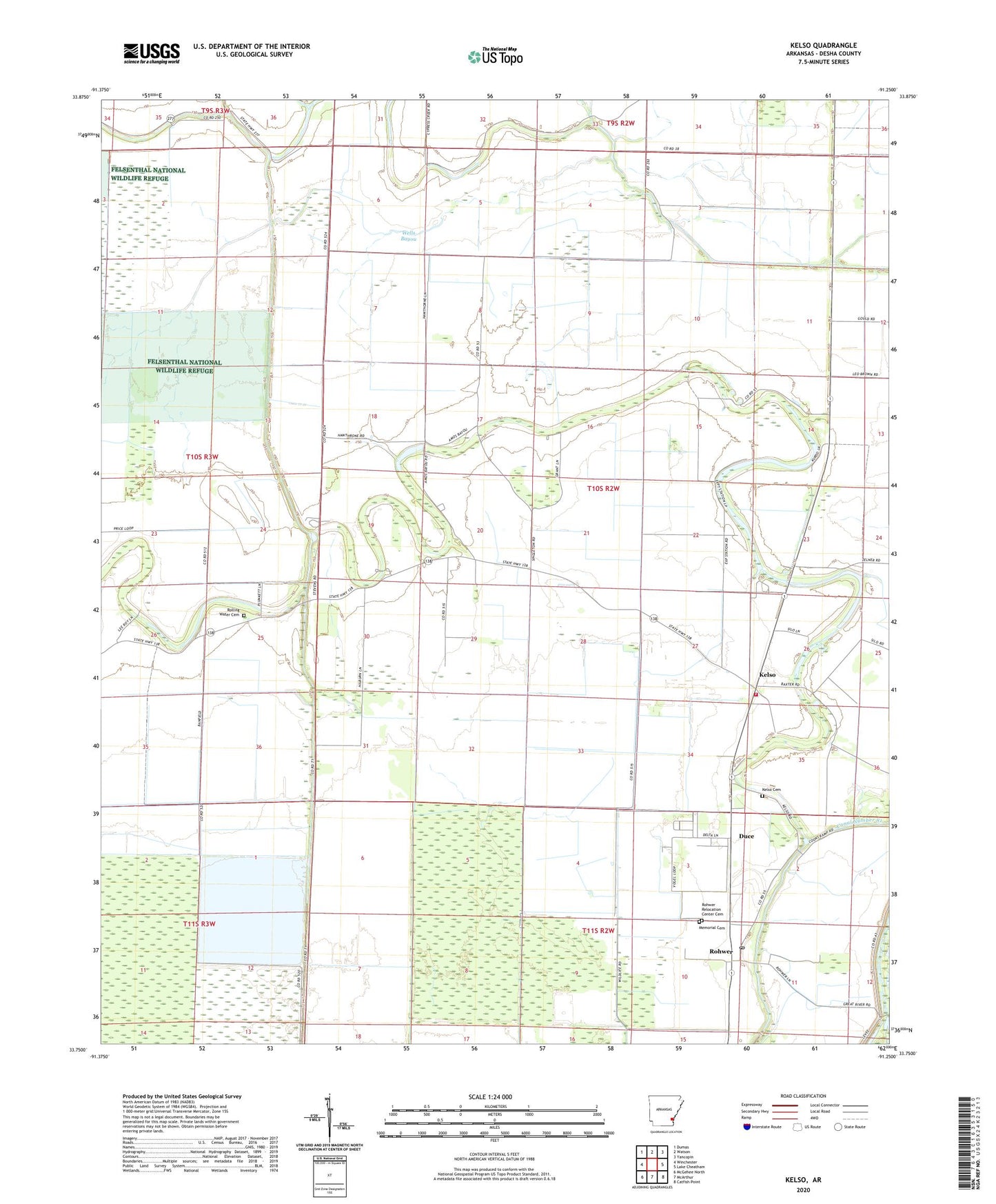
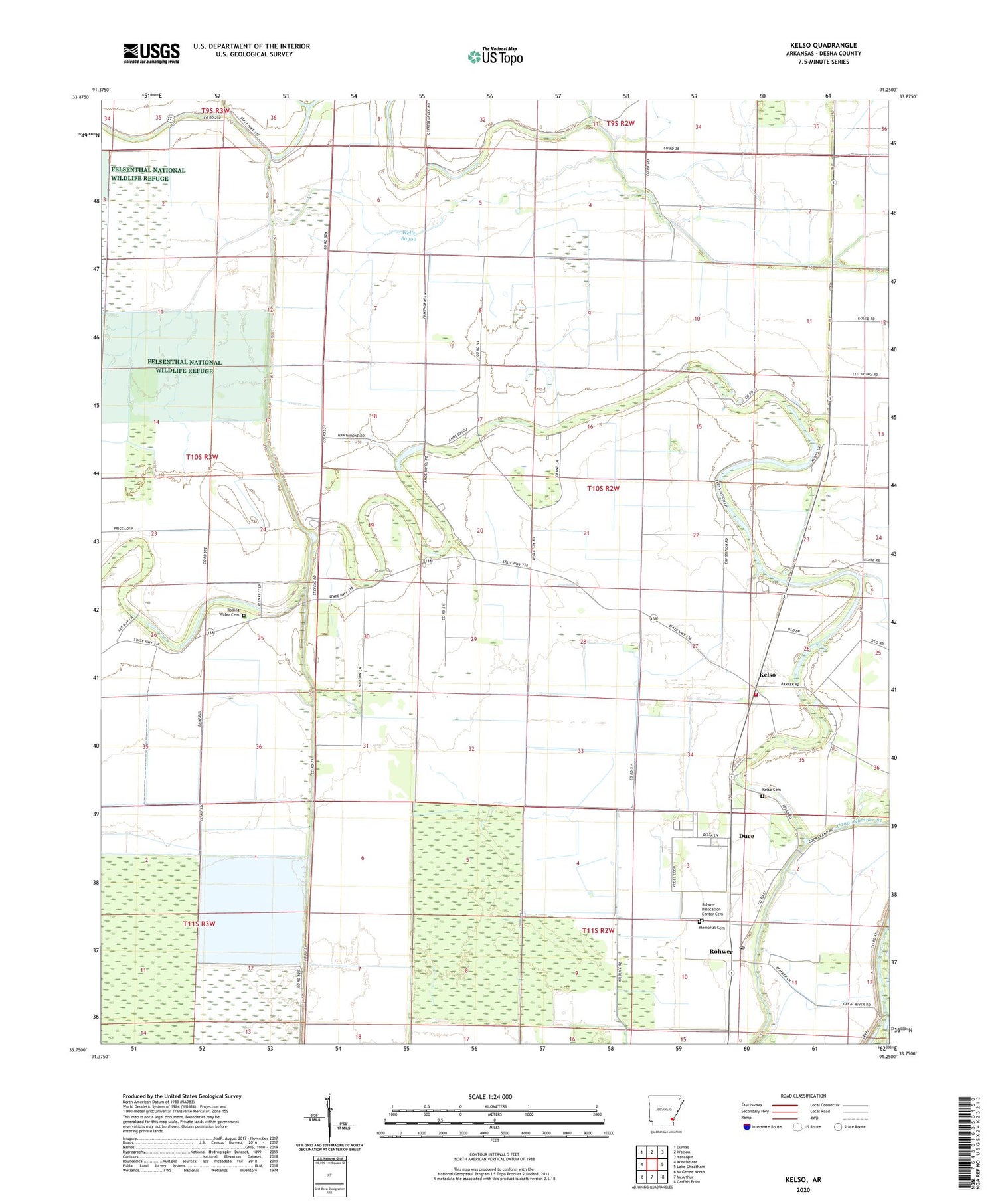
Kelso Arkansas US Topo Map
Couldn't load pickup availability
2024 topographic map quadrangle Kelso in the state of Arkansas. Scale: 1:24000. Based on the newly updated USGS 7.5' US Topo map series, this map is in the following counties: Desha. The map contains contour data, water features, and other items you are used to seeing on USGS maps, but also has updated roads and other features. This is the next generation of topographic maps. Printed on high-quality waterproof paper with UV fade-resistant inks.
Quads adjacent to this one:
West: Winchester
Northwest: Dumas
North: Watson
Northeast: Yancopin
East: Lake Cheatham
Southeast: Catfish Point
South: McArthur
Southwest: McGehee North
This map covers the same area as the classic USGS quad with code o33091g3.
Contains the following named places: Amos Bayou Church, Delta Elementary School, Delta High School, Desha Central High School, Desha County, Duce, Kelso, Kelso Cemetery, Kelso Rohwer Fire Department, Kurdo, Littles, Memorial Cemetery, Oak Grove Church, Richland Baptist Church, Rohwer, Rohwer Post Office, Rohwer Relocation Center Cemetery, Rohwer War Relocation Center, Rolling Water Cemetery, Saint Lake Church, Township of Richland, United Pentecostal Church, Zellner, ZIP Code: 71666