MyTopo
Mineral Springs North Arkansas US Topo Map
Couldn't load pickup availability
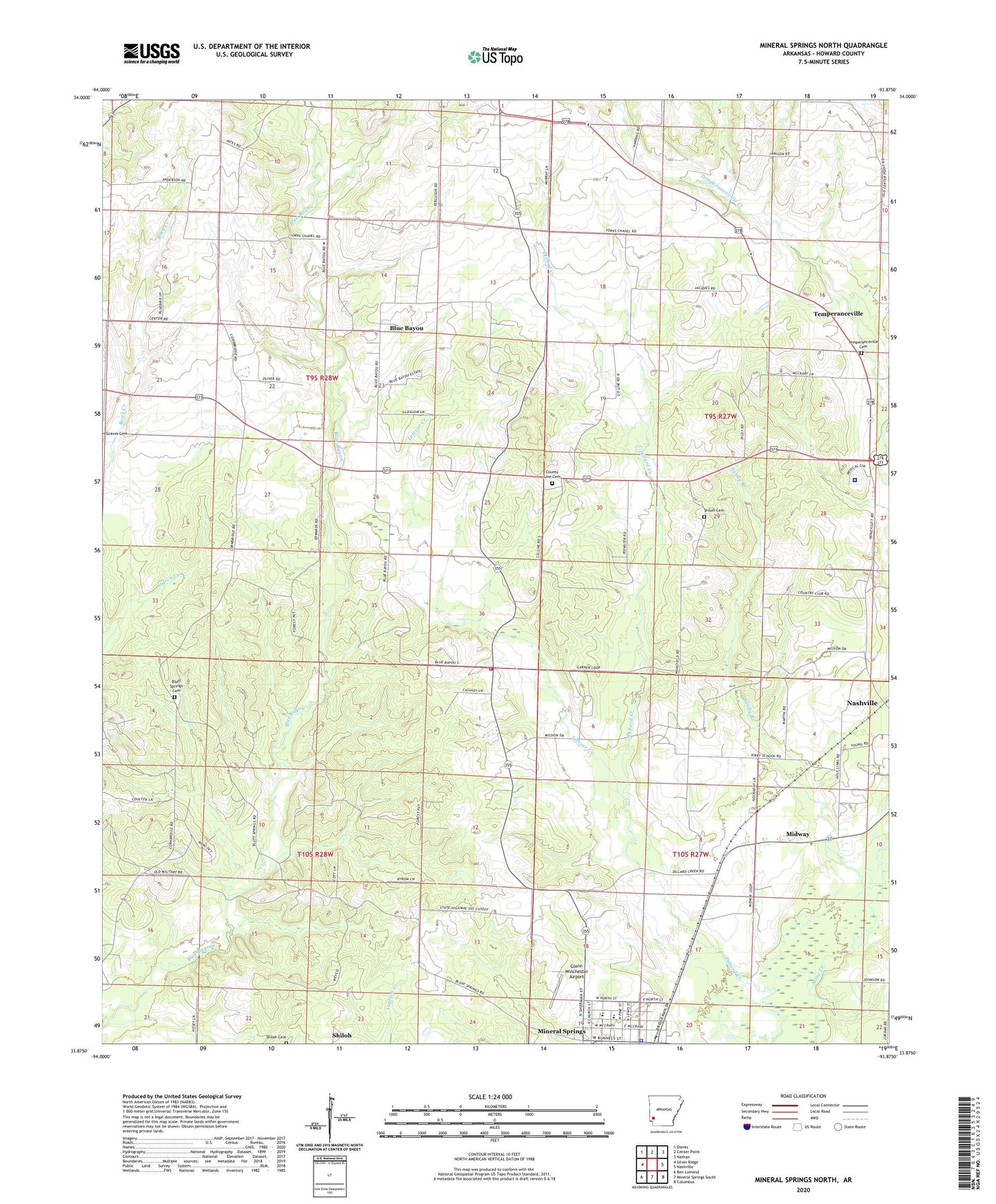
2024 topographic map quadrangle Mineral Springs North in the state of Arkansas. Scale: 1:24000. Based on the newly updated USGS 7.5' US Topo map series, this map is in the following counties: Howard. The map contains contour data, water features, and other items you are used to seeing on USGS maps, but also has updated roads and other features. This is the next generation of topographic maps. Printed on high-quality waterproof paper with UV fade-resistant inks.
Quads adjacent to this one:
West: Silver Ridge
Northwest: Dierks
North: Center Point
Northeast: Nathan
East: Nashville
Southeast: Columbus
South: Mineral Springs South
Southwest: Ben Lomond
This map covers the same area as the classic USGS quad with code o33093h8.
Contains the following named places: Amity, Baber Store, Bayou Store, Blue Bayou, Blue Bayou Church, Bluff Spring Church, Bluff Springs Cemetery, City of Mineral Springs, County Line, County Line Cemetery, County Line Church, County Line Rural Volunteer Fire Department, Dildy School, Dillard School, Flint Hill Church, Forgy, Forty Five School, Glenn Winchester Airport, Holcombe Store, Howard Memorial Hospital, Kirby School, Lefever Creek, Little Bayou, Midway, Midway Church, Mineral Springs, Mineral Springs Elementary School, Mineral Springs High School, Mineral Springs Police Department, Mineral Springs School, Mount Olive, New Mount Zion Church, Old 45 School, Plainview Church, Rock Springs School, Sandy Branch, Shiloh Cemetery, Temperanceville, Temperanceville Cemetery, Temperanceville Church, Township of County Line, Township of Dillard, Trinity Methodist Church, University of Arkansas Peach Experiment Station, Wakefield, Wakefield Church, York Chapel, Yorks Chapel School