
MyTopo
Portland Arkansas US Topo Map
Couldn't load pickup availability
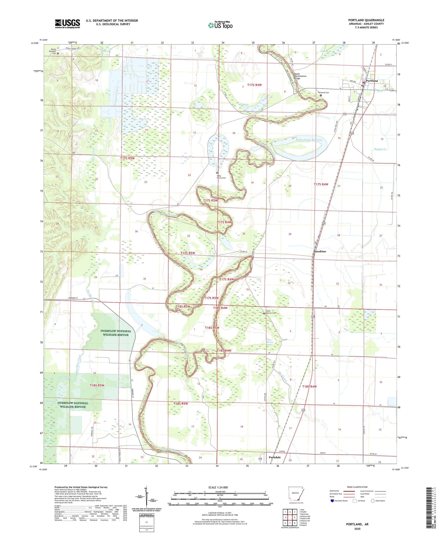
2024 topographic map quadrangle Portland in the state of Arkansas. Scale: 1:24000. Based on the newly updated USGS 7.5' US Topo map series, this map is in the following counties: Ashley. The map contains contour data, water features, and other items you are used to seeing on USGS maps, but also has updated roads and other features. This is the next generation of topographic maps. Printed on high-quality waterproof paper with UV fade-resistant inks.
Quads adjacent to this one:
West: Wilmot NW
Northwest: Mist
North: Snyder
Northeast: Montrose
East: Eudora NW
Southeast: Empire
South: Wilmot
Southwest: Wilmot SW
This map covers the same area as the classic USGS quad with code o33091b5.
Contains the following named places: Alligator Bluff School, Anthony Lake, Bayou Bartholomew Bridge, Bear Brake, City of Portland, Holly Grove Cemetery, Holly Grove Church, Mount Olive Church, Mount Pleasant, Mount Pleasant Baptist Church, Mount Pleasant Cemetery, New Light Church, Portland, Portland Cemetery, Portland Elementary School, Portland Fire Department, Portland Police Department, Portland Post Office, Saint Johns Church, Saint Marion Brake, Saint Marion Cemetery, Saint Marion Church, Sanders Lake, Sunshine, Tillis High School, Township of Portland, Union Church, United States Fish and Wildlife Overflow National Wildlife Refuge Park Security, Wilson Brake, Wilson Brake Dam, Wilson Brake Reservoir, ZIP Code: 71661


