MyTopo
Newhope Arkansas US Topo Map
Couldn't load pickup availability
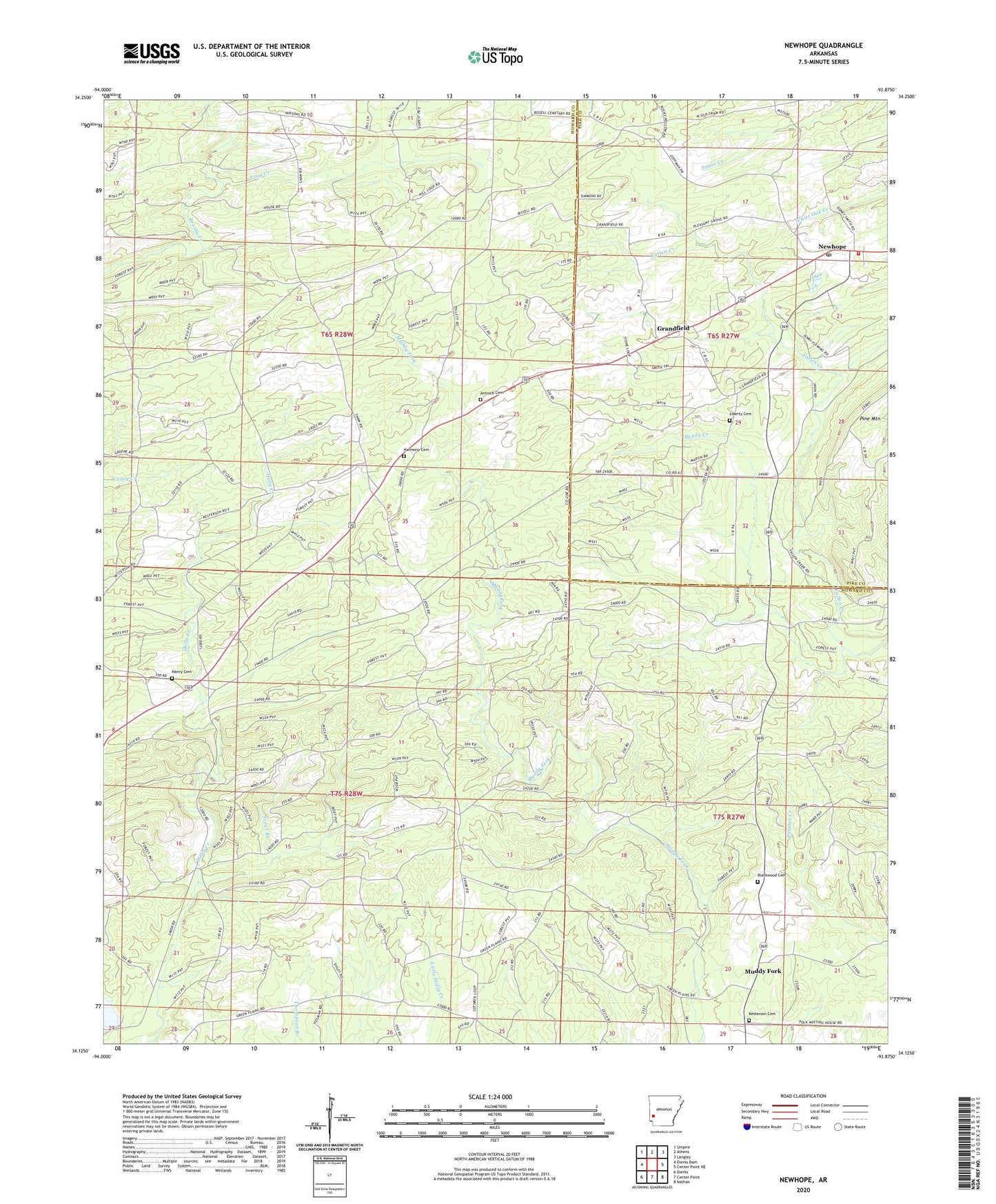
2024 topographic map quadrangle Newhope in the state of Arkansas. Scale: 1:24000. Based on the newly updated USGS 7.5' US Topo map series, this map is in the following counties: Howard, Pike. The map contains contour data, water features, and other items you are used to seeing on USGS maps, but also has updated roads and other features. This is the next generation of topographic maps. Printed on high-quality waterproof paper with UV fade-resistant inks.
Quads adjacent to this one:
West: Dierks Dam
Northwest: Umpire
North: Athens
Northeast: Langley
East: Center Point NE
Southeast: Nathan
South: Center Point
Southwest: Dierks
This map covers the same area as the classic USGS quad with code o34093b8.
Contains the following named places: Antioch Cemetery, Antioch Church, Bandy Creek, Bissell, Blackwood Cemetery, Dierks Lake, Grandfield, Green Plains, Green Plains Church, Green Plains School, Harmony Cemetery, Harmony Church, Hattie, Henry Cemetery, Kesterson Cemetery, Liberty Cemetery, Long Creek, Muddy Fork, New Hope Fire Department, Newhope, Newhope Census Designated Place, Newhope Post Office, Pleasant Grove Church, Slip-Up and Hitch, Township of Clay, Trout Branch, ZIP Code: 71959