MyTopo
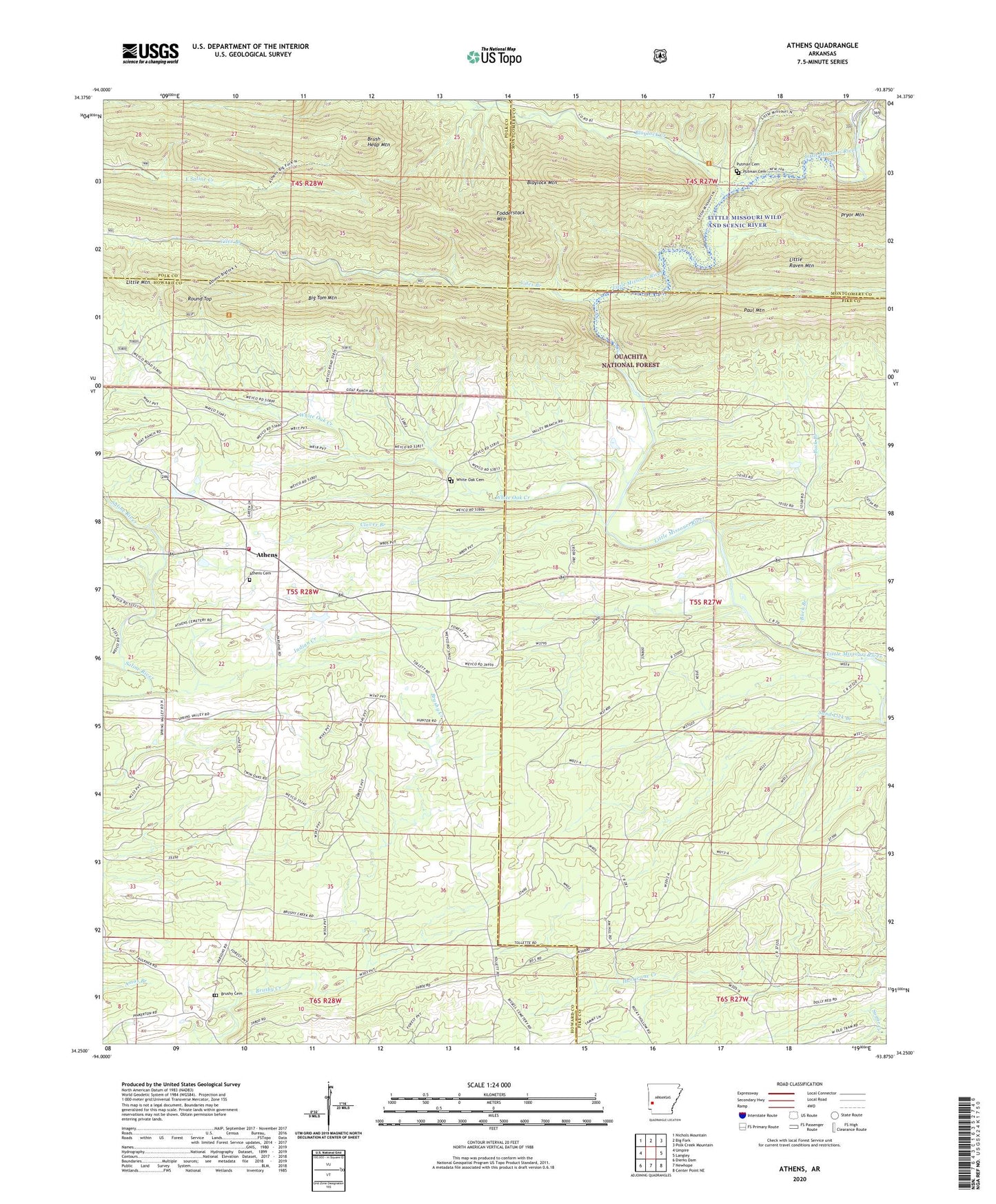
Athens Arkansas US Topo Map
Couldn't load pickup availability
2024 topographic map quadrangle Athens in the state of Arkansas. Scale: 1:24000. Based on the newly updated USGS 7.5' US Topo map series, this map is in the following counties: Howard, Pike, Polk, Montgomery. The map contains contour data, water features, and other items you are used to seeing on USGS maps, but also has updated roads and other features. This is the next generation of topographic maps. Printed on high-quality waterproof paper with UV fade-resistant inks.
Quads adjacent to this one:
West: Umpire
Northwest: Nichols Mountain
North: Big Fork
Northeast: Polk Creek Mountain
East: Langley
Southeast: Center Point NE
South: Newhope
Southwest: Dierks Dam
This map covers the same area as the classic USGS quad with code o34093c8.
Contains the following named places: Albert Pike Recreation Area, Albert School, Athens, Athens Cemetery, Athens Fire Department, Big Tom Mountain, Blaylock Creek, Blaylock Mountain, Brush Heap Mountain, Brushy, Brushy Cemetery, Brushy School, Buck Branch, Clover Branch, Fodderstack Mountain, Henry, Henry School, Indian Creek, Little Mountain, Miller School, Misels Chapel, New Thompson, Old Thompson, Pates, Pleasant Hill School, Putman Cemetery, Roaring Branch Natural Area, Round Top, Sand Lick Branch, Township of Mountain, Viles Branch, White Oak Cemetery, White Oak Creek