MyTopo
Ponca Arkansas US Topo Map
Couldn't load pickup availability
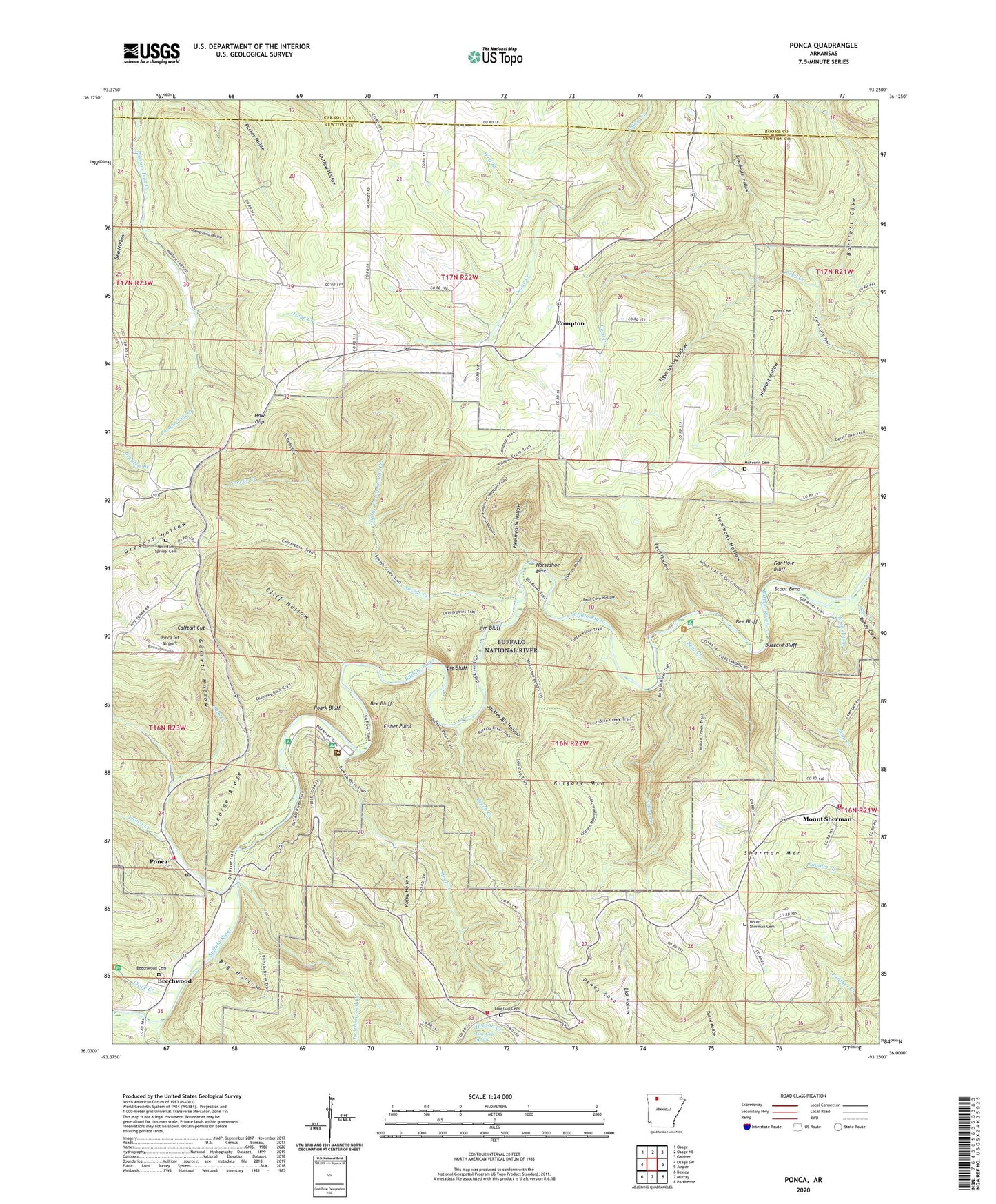
2024 topographic map quadrangle Ponca in the state of Arkansas. Scale: 1:24000. Based on the newly updated USGS 7.5' US Topo map series, this map is in the following counties: Newton, Boone, Carroll. The map contains contour data, water features, and other items you are used to seeing on USGS maps, but also has updated roads and other features. This is the next generation of topographic maps. Printed on high-quality waterproof paper with UV fade-resistant inks.
Quads adjacent to this one:
West: Osage SW
Northwest: Osage
North: Osage NE
Northeast: Gaither
East: Jasper
Southeast: Parthenon
South: Murray
Southwest: Boxley
This map covers the same area as the classic USGS quad with code o36093a3.
Contains the following named places: Adds Creek, Bartlett Cove, Bear Cave Hollow, Bear Creek, Bee Bluff, Bee Hollow, Beech Creek, Beechwood, Beechwood Cemetery, Big Bluff, Big Hollow, Broadwater Hollow, Buffalo National River (Ponca Unit) Wilderness, Buzzard Bluff, Calftail Cut, California Point, Camp Orr, Cecil Hollow, Clark Creek, Clemmons Hollow, Cliff Hollow, Compton, Compton Lookout Tower, Compton Post Office, Compton School, Compton Volunteer Fire Department, Dewey Cove, Dry Creek, Fisher Point, Fishtrap Hollow, Gar Hole Bluff, George Ridge, Gossett Hollow, Hanner Point, Haw Gap, Hemmed-In Hollow, Hideout Hollow, Horseshoe Bend, Indian Creek, Jackie Hollow, Jackies Big Hollow, Jim Bluff, Jones Cemetery, Kilgore Mountain, Kyles Landing, Lamb Cove, Leatherwood Creek, Lick Ford, Lost Valley State Park, Low Gap, Low Gap Cemetery, Low Gap School, Low Gap Spring, McFerrin Cemetery, McFerrin Point, Middle Prong Sneeds Creek, Mount Sherman, Mount Sherman Cemetery, Mount Sherman School, Mount Sherman Volunteer Fire Department, Mount Sherman Volunteer Fire Department Low Gap Substation, Mountain Springs Cemetery, Mountain Springs Church, Mountain Springs School, Newground Hollow, Pickert Point, Plumlee, Plumlee Church, Plumlee School, Ponca, Ponca Census Designated Place, Ponca Creek, Ponca Int Airport, Ponca Post Office, Ponca Volunteer Fire Department, Queen Point, Raney Cove, Roark Bluff, Rock Bridge Creek, Rocky Hollow, Running Creek, Scout Bend, Sherman Mountain, Shop Creek, Sneeds Creek, Steel Creek, Tiggs Spring Hollow, Township of Low Gap, Township of Plumlee, Wolf Branch