MyTopo
Osage NE Arkansas US Topo Map
Couldn't load pickup availability
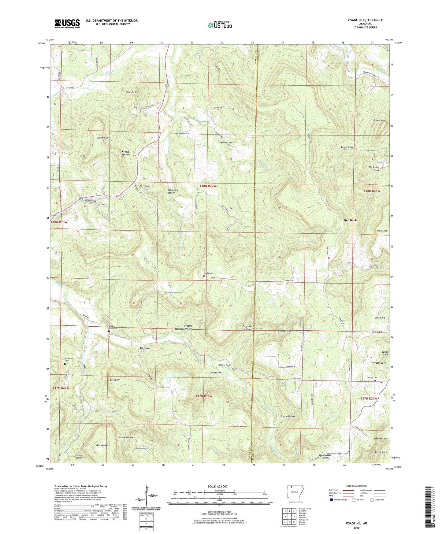
2024 topographic map quadrangle Osage NE in the state of Arkansas. Scale: 1:24000. Based on the newly updated USGS 7.5' US Topo map series, this map is in the following counties: Carroll, Boone. The map contains contour data, water features, and other items you are used to seeing on USGS maps, but also has updated roads and other features. This is the next generation of topographic maps. Printed on high-quality waterproof paper with UV fade-resistant inks.
Quads adjacent to this one:
West: Osage
Northwest: Green Forest
North: Alpena
Northeast: Batavia
East: Gaither
Southeast: Jasper
South: Ponca
Southwest: Osage SW
This map covers the same area as the classic USGS quad with code o36093b3.
Contains the following named places: Alford Cove, Bee Bluff, Big Spring, Big Spring Draw, Brewer Lake, Brewer Lake Dam, Butler Cove, Delmar, Denton Cove, Dishrown Creek, Dodson Mountain, Dog Branch Cemetery, Ferguson Hollow, Gibbs Cemetery, Hill Top, Hill Top Church of Christ, Hill Top Fire Department Station 1, Hilltop Cemetery, Holden Mountain, Mc Million Cemetery, Micks Branch, Needle Eye Mountain, Outlaw Hollow, Owl Hollow, Parton Hollow, Phelps Hollow, Pilot Knob, Pitcher Hollow, Possum Trot Church, Possum Trot Creek, Red Bank, Rocky Fork, Round Mountain, Shady Grove Cemetery, Shady Grove Church, Township of Carrollton, Township of Delmar, Township of Summit, Tucker Cove, Whooping Hollow, Winding Staircase Hollow, ZIP Code: 72611