MyTopo
Osage SW Arkansas US Topo Map
Couldn't load pickup availability
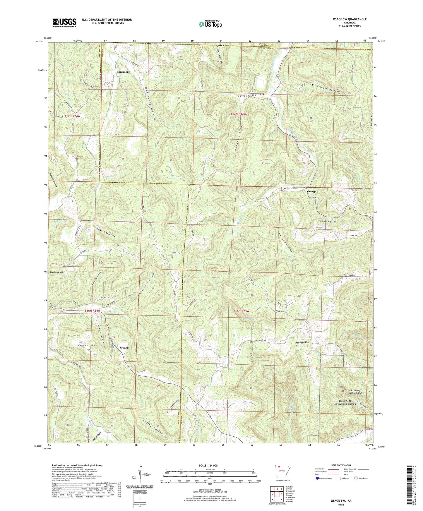
2024 topographic map quadrangle Osage SW in the state of Arkansas. Scale: 1:24000. Based on the newly updated USGS 7.5' US Topo map series, this map is in the following counties: Newton, Madison, Carroll. The map contains contour data, water features, and other items you are used to seeing on USGS maps, but also has updated roads and other features. This is the next generation of topographic maps. Printed on high-quality waterproof paper with UV fade-resistant inks.
Quads adjacent to this one:
West: Kingston
Northwest: Marble
North: Osage
Northeast: Osage NE
East: Ponca
Southeast: Murray
South: Boxley
Southwest: Weathers
This map covers the same area as the classic USGS quad with code o36093a4.
Contains the following named places: Allfriend, Arms Mountain, Bradley Branch, Bradshaw Mountain, Cockran Hollow, Cook Hollow, Cove Hollow, Dinsmore, Eden Falls, Elkhorn Church, George, Grogans Hollow, Hamstring Hollow, Hopewell Cemetery, Howe Hollow, Lawson Hollow, Liberty Church, Logan Mountain, Lost Valley Natural Bridge, McCullough Hollow, Pickle Hollow, Smelley Hollow, Stoverville, Sugar Camp Hollow, Township of Osage, Township of Ponca, ZIP Code: 72624