MyTopo
Boxley Arkansas US Topo Map
Couldn't load pickup availability
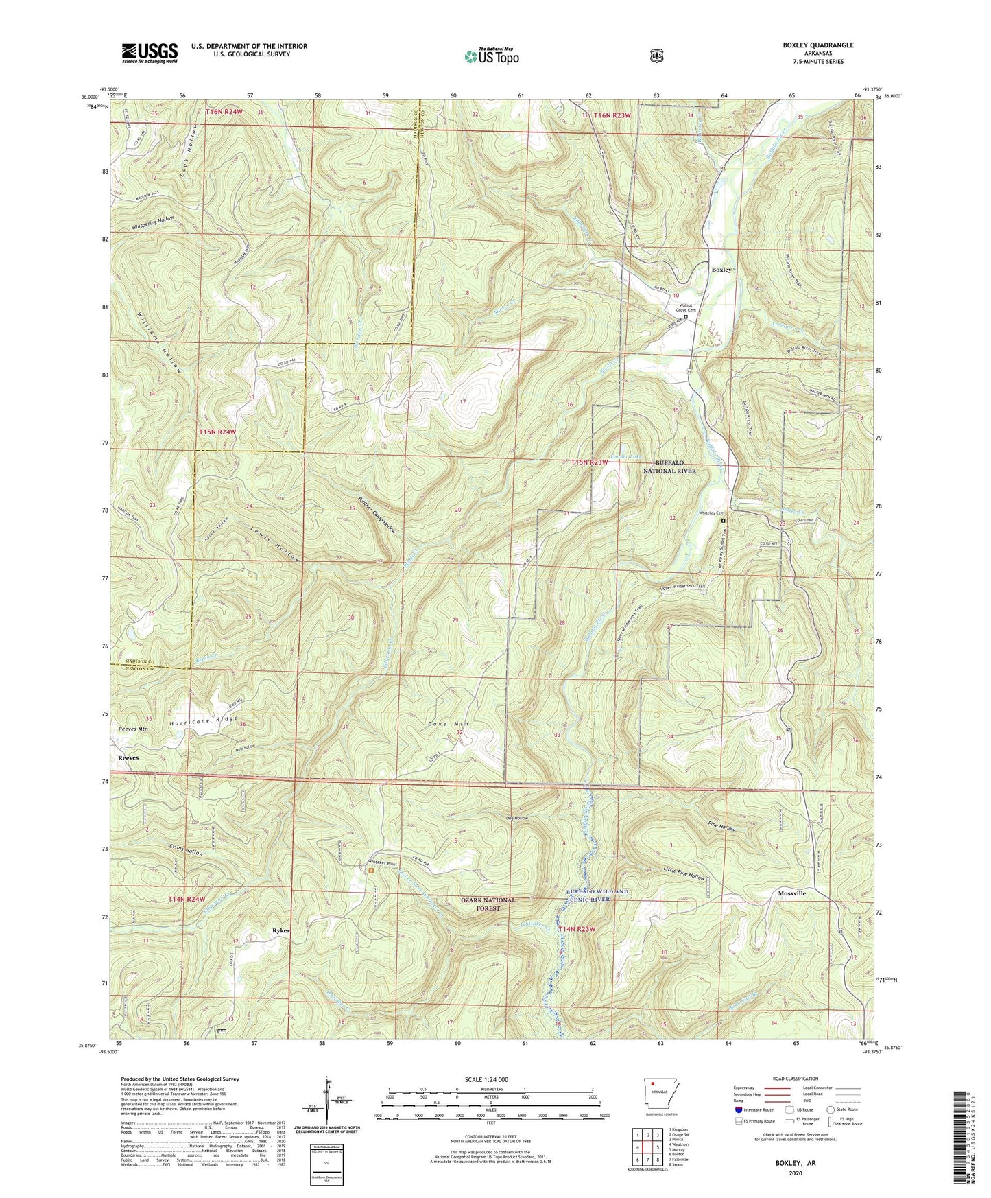
2024 topographic map quadrangle Boxley in the state of Arkansas. Scale: 1:24000. Based on the newly updated USGS 7.5' US Topo map series, this map is in the following counties: Newton, Madison. The map contains contour data, water features, and other items you are used to seeing on USGS maps, but also has updated roads and other features. This is the next generation of topographic maps. Printed on high-quality waterproof paper with UV fade-resistant inks.
Quads adjacent to this one:
West: Weathers
Northwest: Kingston
North: Osage SW
Northeast: Ponca
East: Murray
Southeast: Swain
South: Fallsville
Southwest: Boston
This map covers the same area as the classic USGS quad with code o35093h4.
Contains the following named places: Arrington Creek, Beech Creek, Boxley, Cave Mountain, Cave Mountain Church, Dug Hollow, Edgeman Creek, Edgemon Creek, Evans Hollow, Fowler Lake, Fowler Lake Dam, Hale Hollow, Harve Hollow, Hurricane Ridge, Lewis Hollow, Little Pine Hollow, Lower Fork Whitaker Creek, Moore Creek, Mossville, Mossville School, Mountain View Church, Panther Camp Hollow, Pine Hollow, Reeves, Reeves Mountain, Ryker, Smith Creek, Township of Kentucky, Township of Van Buren, Walnut Grove Cemetery, Walnut Grove Church, Walnut Grove School, Whitaker Creek, Whiteley Cemetery, Whiteley Creek, Williams Hollow, ZIP Code: 72670