MyTopo
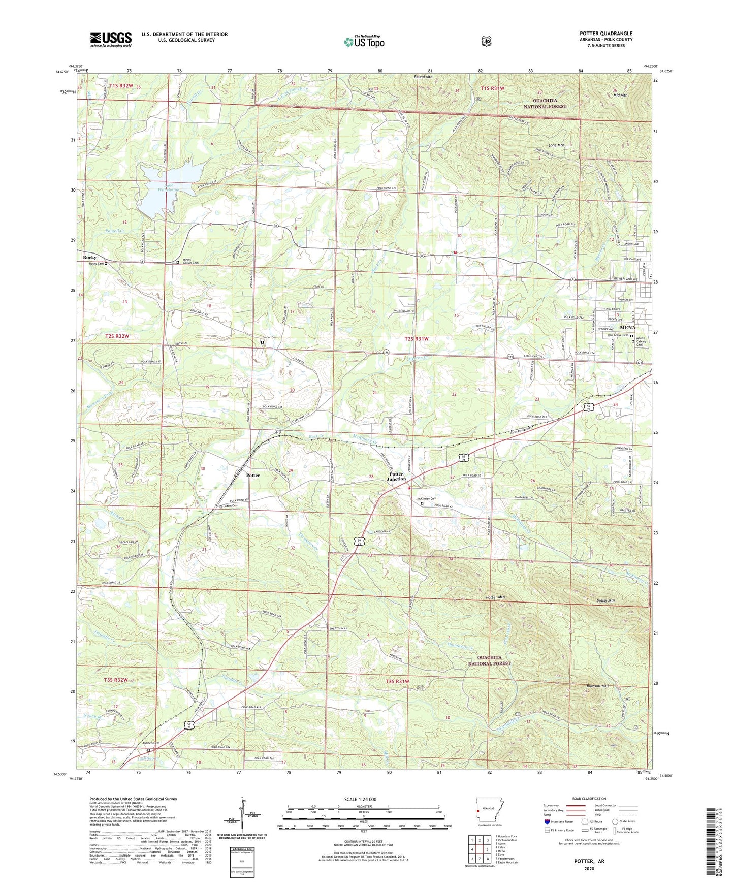
Potter Arkansas US Topo Map
Couldn't load pickup availability
Also explore the Potter Forest Service Topo of this same quad for updated USFS data
2024 topographic map quadrangle Potter in the state of Arkansas. Scale: 1:24000. Based on the newly updated USGS 7.5' US Topo map series, this map is in the following counties: Polk. The map contains contour data, water features, and other items you are used to seeing on USGS maps, but also has updated roads and other features. This is the next generation of topographic maps. Printed on high-quality waterproof paper with UV fade-resistant inks.
Quads adjacent to this one:
West: Zafra
Northwest: Mountain Fork
North: Rich Mountain
Northeast: Acorn
East: Mena
Southeast: Eagle Mountain
South: Vandervoort
Southwest: Cove
This map covers the same area as the classic USGS quad with code o34094e3.
Contains the following named places: Antioch Cemetery, Bethel Church, Blowout Mountain, Blue Lake, Blue Lake Dam, Clear Fork, East Fork Powell Creek, Faith Missionary Baptist Church, Foster Cemetery, Foster Chapel, Gann, Gann Cemetery, Gann Chapel, KOUA-FM (Mena), Lake Wilhelmina, Lake Wilhelmina Dam, Lionsk Club Golf Course, Long Mountain, Louise Durham Elementary School, McKinney Cemetery, McKinney Creek, Merren Creek, Middle Mountain, Mill Creek, Mount Calvary Cemetery, Mount Gillian Cemetery, Mountain View United Methodist Church, Oak Grove Cemetery, Old Potter Presbyterian Church, Old Potter School, Olivers Chapel, Polk County Fairgrounds, Potter, Potter Junction, Potter Mountain, Potter School, Potter Station Fire District 13, Rocky, Rocky Cemetery, Rocky Methodist Church, Shady Grove, Shady Grove Church, Shady Grove Fire and Rescue, South 71 Church of Christ, Sweetwater Creek, Thompson Creek, Township of Eagle, Township of Potter, Two Mile, Two Mile Baptist Church