MyTopo
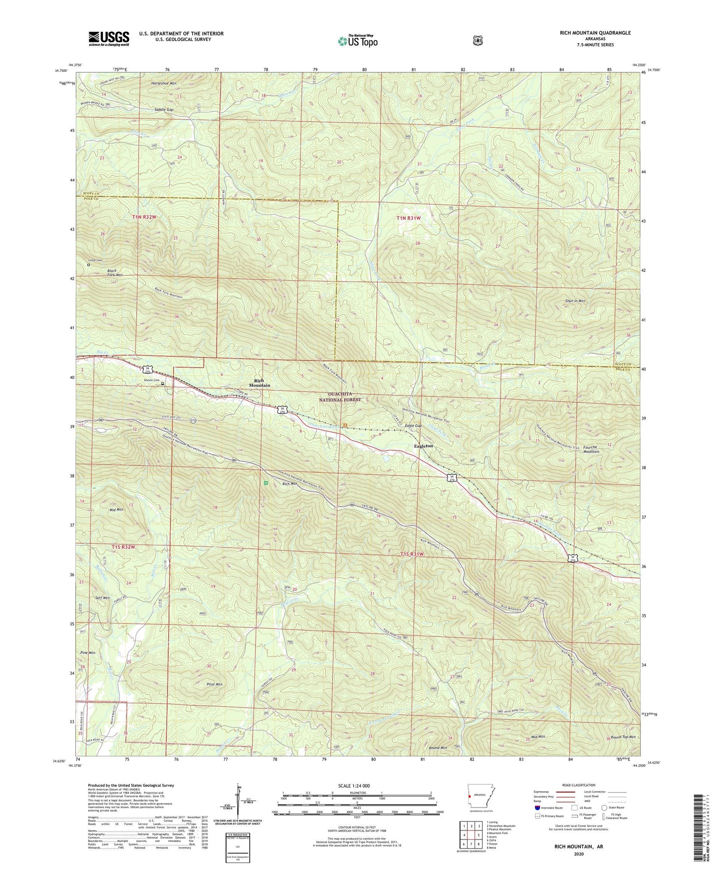
Rich Mountain Arkansas US Topo Map
Couldn't load pickup availability
Also explore the Rich Mountain Forest Service Topo of this same quad for updated USFS data
2024 topographic map quadrangle Rich Mountain in the state of Arkansas. Scale: 1:24000. Based on the newly updated USGS 7.5' US Topo map series, this map is in the following counties: Polk, Scott. The map contains contour data, water features, and other items you are used to seeing on USGS maps, but also has updated roads and other features. This is the next generation of topographic maps. Printed on high-quality waterproof paper with UV fade-resistant inks.
Quads adjacent to this one:
West: Mountain Fork
Northwest: Loving
North: Horseshoe Mountain
Northeast: Peanut Mountain
East: Acorn
Southeast: Mena
South: Potter
Southwest: Zafra
This map covers the same area as the classic USGS quad with code o34094f3.
Contains the following named places: Black Fork Mountain, Bufram Creek, Center Point, Center Point Church, Eagle Gap, Eagle Gap Ranger Station, Eagleton, Little Cemetery, Pilot Mountain, Queen Wilhelmina State Park, Rich Mountain, Rich Mountain Church, Rich Mountain Lookout Tower, Rich Mountain Tower Recreation Area, Round Mountain, Round Top Mountain, Saddle Gap, Salt Creek, Sexton Cemetery, Shut-In Mountain, Township of Acorn, Township of Rich Mountain