MyTopo
Cove Arkansas US Topo Map
Couldn't load pickup availability
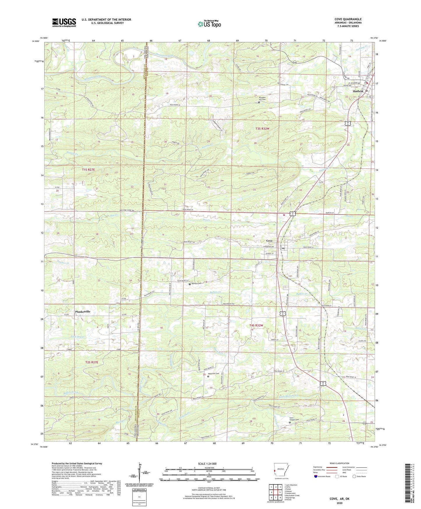
2024 topographic map quadrangle Cove in the states of Arkansas, Oklahoma. Scale: 1:24000. Based on the newly updated USGS 7.5' US Topo map series, this map is in the following counties: Polk, McCurtain. The map contains contour data, water features, and other items you are used to seeing on USGS maps, but also has updated roads and other features. This is the next generation of topographic maps. Printed on high-quality waterproof paper with UV fade-resistant inks.
Quads adjacent to this one:
West: Watson
Northwest: Lynn Mountain
North: Zafra
Northeast: Potter
East: Vandervoort
Southeast: Wickes
South: Bog Springs
Southwest: Big Hudson Creek
Contains the following named places: Barren Creek, Buffalo, Buffalo Baptist Church, Buffalo Cemetery, Cecil Chapel, Cecil Chapel Cemetery, Christs Church, Clayton Spur, Cove, Cove Post Office, Cove Volunteer Fire Station 3, Cow Creek, Hatfield, Hatfield Elementary School, Hatfield First Baptist Church, Hatfield Freewill Baptist Church, Hatfield High School, Hatfield Post Office, Hatfield Station Fire District 4, Hickory Creek, Indian Creek, Little Hickory Creek, Midway Independent Baptist Church, Old Cove School, Panther Creek Church, Piney Church, Piney Grove School, Piney School, Pleasant Grove Church, Pleasant Hill, Pleasant Hill Cemetery, Pleasant Hill Freewill Baptist Church, Plunketville, Rock Creek, Town of Cove, Town of Hatfield, Van Cove High School, Van-Cove High School, Welcome Home School, West View School, Westview Cemetery, Westview Church, ZIP Code: 71937