MyTopo
Ravenden Arkansas US Topo Map
Couldn't load pickup availability
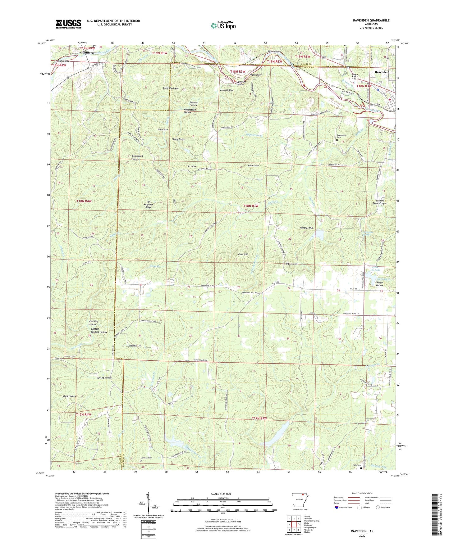
2024 topographic map quadrangle Ravenden in the state of Arkansas. Scale: 1:24000. Based on the newly updated USGS 7.5' US Topo map series, this map is in the following counties: Lawrence, Sharp. The map contains contour data, water features, and other items you are used to seeing on USGS maps, but also has updated roads and other features. This is the next generation of topographic maps. Printed on high-quality waterproof paper with UV fade-resistant inks.
Quads adjacent to this one:
West: Sitka
Northwest: Hardy
North: Williford
Northeast: Ravenden Springs
East: Imboden
Southeast: Eaton
South: Smithville
Southwest: Poughkeepsie
This map covers the same area as the classic USGS quad with code o36091b3.
Contains the following named places: Amos Hollow, Bald Knob, Ball Hollow, Bates Creek, Big Lick Hill, Browns Creek, Buzzard Hollow, Buzzard Roost Canyon, Camp Branch, Captain Sanders Hollow, Carl Phillips Lake Dam, Cave Hill, Coffman Cemetery, Cooper Creek Site Two Dam, Cooper Creek Site Two Reservoir, East Prong Wells Creek, Field Mountain, Friendship Church, Frisbee, Gattis Creek, Goat Shed Mountain, Graveyard Ridge, Homestead Hollow, Jeff Creek, Little Joe Lake, Lone Oak Church, Mill Hollow, Mount Olive, Oliver Creek, Opossum Hollow, Opposition, Opposition Cemetery, Opposition Creek, Panther Hill, Park Cemetery, Ravenden, Ravenden Police Department, Ravenden Post Office, Ravenden Volunteer Fire Department, Town of Ravenden, Township of Spring River, Township of Thacker, Upton Creek, Van Wagoner Ridge, Watts Bluff, Wautauga Spring, Wells Creek, Wild Hog Hollow, Williford Post Office, Young Ridge