MyTopo
Quitman Arkansas US Topo Map
Couldn't load pickup availability
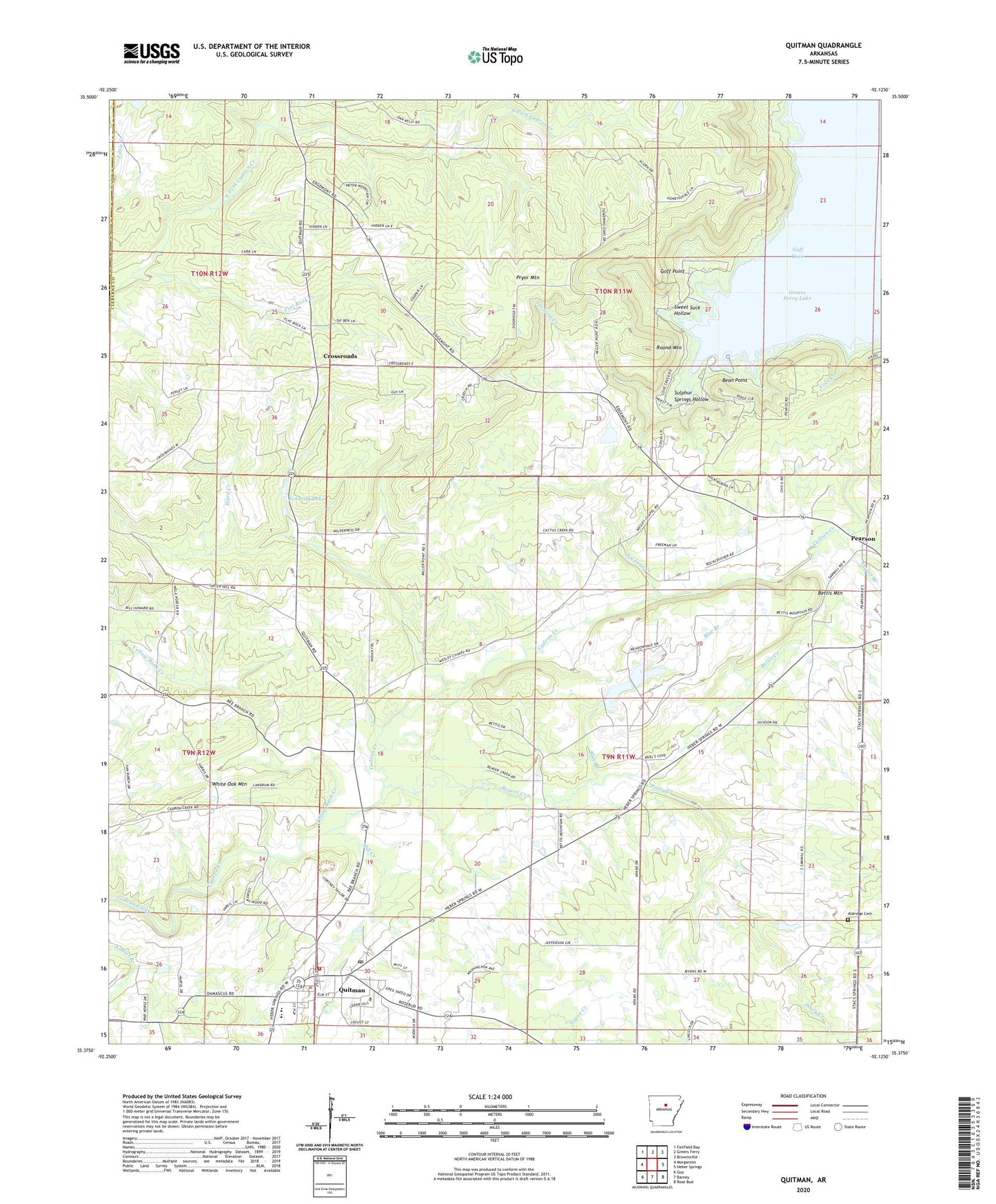
2024 topographic map quadrangle Quitman in the state of Arkansas. Scale: 1:24000. Based on the newly updated USGS 7.5' US Topo map series, this map is in the following counties: Cleburne, Van Buren. The map contains contour data, water features, and other items you are used to seeing on USGS maps, but also has updated roads and other features. This is the next generation of topographic maps. Printed on high-quality waterproof paper with UV fade-resistant inks.
Quads adjacent to this one:
West: Morganton
Northwest: Fairfield Bay
North: Greers Ferry
Northeast: Brownsville
East: Heber Springs
Southeast: Rose Bud
South: Barney
Southwest: Guy
This map covers the same area as the classic USGS quad with code o35092d2.
Contains the following named places: Aldridge Cemetery, Bean Point, Beaver Creek, Bettis Creek, Bettis Mountain, Blue Branch, City of Quitman, Cove Creek Recreation Area, Cove Creek Volunteer Fire Department Main Station, Crossroads, Crossroads Community Church, Flat Rock Baptist Church, Flat Rock Creek, Goff Cove, Goff Point, Goodloe Chapel Methodist Church, Howard Baptist Church, Jackson Creek, Kennedy Lake, Kennedy Lake Dam, Mill Creek, Miss Jenny Lake, Miss Jenny Lake Dam, New Bethany Baptist Church, Palestine Baptist Church, Pearson, Pearson School, Piney Creek, Pryor Mountain, Quitman, Quitman Elementary School, Quitman High School, Quitman Police Department, Quitman Post Office, Quitman Rescue, Quitman Volunteer Fire Department, Round Mountain, Sulphur Springs Hollow, Sweet Suck Hollow, Tabernacle Branch, Taylor Branch, Township of Cadron, Township of Center Post, Township of Clayton, Township of North Cadron, Township of South Cadron, Ward Creek, Wesley Chapel, Yellow Bank Creek, ZIP Code: 72131


