MyTopo
Brownsville Arkansas US Topo Map
Couldn't load pickup availability
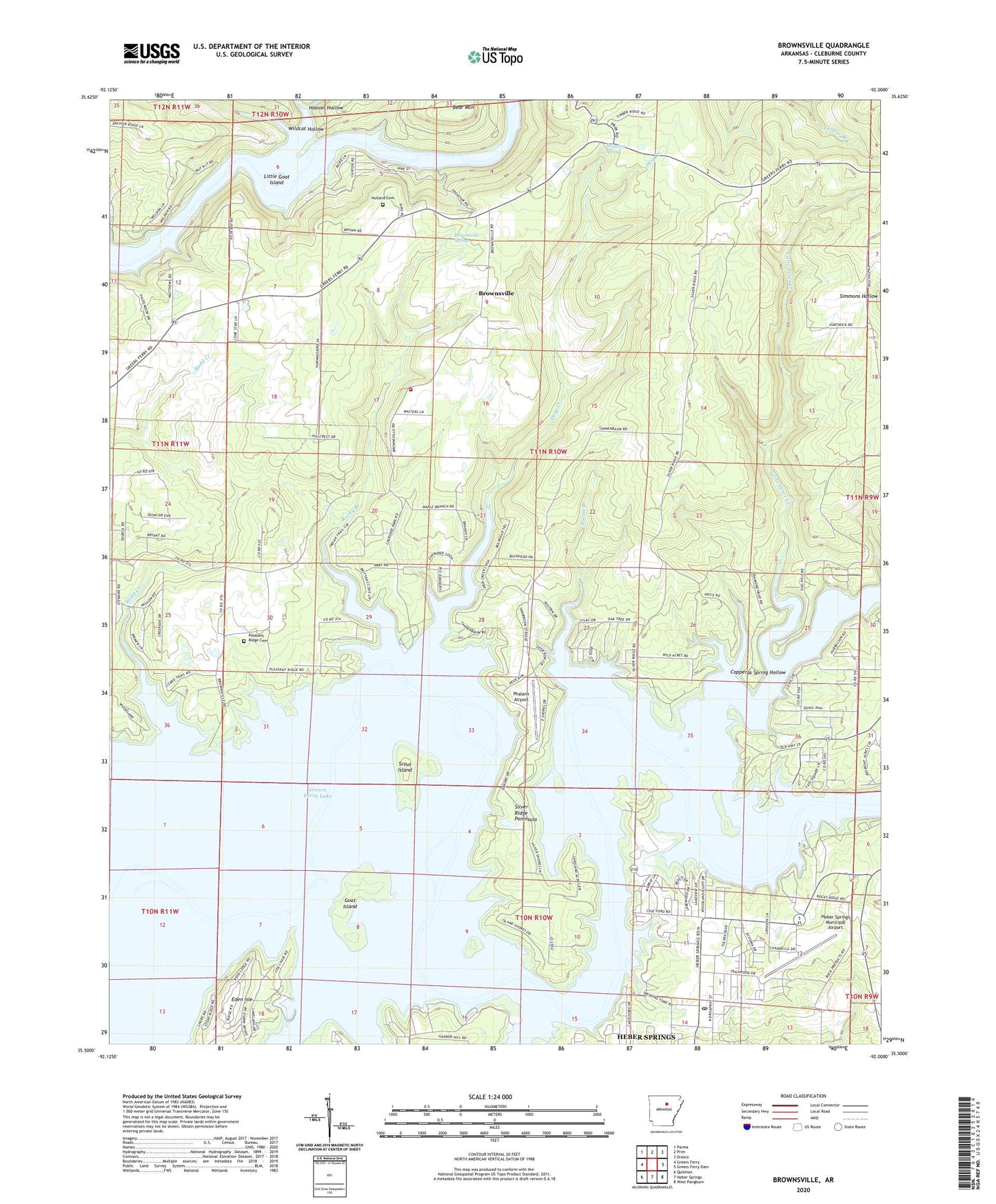
2024 topographic map quadrangle Brownsville in the state of Arkansas. Scale: 1:24000. Based on the newly updated USGS 7.5' US Topo map series, this map is in the following counties: Cleburne. The map contains contour data, water features, and other items you are used to seeing on USGS maps, but also has updated roads and other features. This is the next generation of topographic maps. Printed on high-quality waterproof paper with UV fade-resistant inks.
Quads adjacent to this one:
West: Greers Ferry
Northwest: Parma
North: Prim
Northeast: Drasco
East: Greers Ferry Dam
Southeast: West Pangburn
South: Heber Springs
Southwest: Quitman
This map covers the same area as the classic USGS quad with code o35092e1.
Contains the following named places: Aaron Branch, Bear Mountain, Brownsville, Brownsville Baptist Church, Brownsville Spring, Budd Creek, Cases Ferry, Cherokee Recreation Area, Cleburne County, Copperas Spring Hollow, Cove Creek, Dam Site Marina, Drip Creek, Dripping Spring, Eden Isle, Eden Isle Marina, Goat Island, Greers Ferry, Greers Ferry Fire Department Station 4, Heber Springs Marina, Heber Springs Municipal Airport, Heber Springs Post Office, Heber Springs Recreation Area, Holland Cemetery, Hoover Hollow, Lake Ridge, Little Goat Island, Little Peter Creek, Lone Star Baptist Church, Lower Ferry, Miller, Old Highway 25 Recreation Areas, Peter Creek, Phalanx Airport, Pleasant Ridge Baptist Church, Pleasant Ridge Cemetery, Pleasant Ridge School, Rocky Branch, Rodgers Lake, Rodgers Lake Dam, Scout Island, Silver Ridge Peninsula, Sugar Camp Creek, Tannenbaum, Thunderbird Golf Course, Township of Francis, Wildcat Hollow, Wilsons Ford