MyTopo
Tyro Arkansas US Topo Map
Couldn't load pickup availability
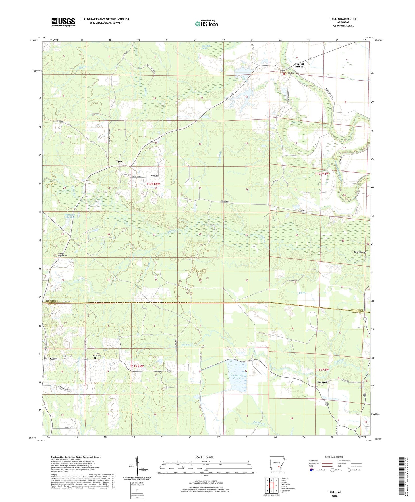
2024 topographic map quadrangle Tyro in the state of Arkansas. Scale: 1:24000. Based on the newly updated USGS 7.5' US Topo map series, this map is in the following counties: Lincoln, Drew. The map contains contour data, water features, and other items you are used to seeing on USGS maps, but also has updated roads and other features. This is the next generation of topographic maps. Printed on high-quality waterproof paper with UV fade-resistant inks.
Quads adjacent to this one:
West: Relfs Bluff
Northwest: Star City
North: Avery
Northeast: Gould
East: Gourd
Southeast: Selma
South: Collins NW
Southwest: Monticello North
This map covers the same area as the classic USGS quad with code o33091g6.
Contains the following named places: Anderson Chapel Baptist Church, Baker Branch, Big Branch, Campbell Brake, Coleman, Farmers Lake, Farmers Lake Dam, Flat Creek, Florence, Florence Baptist Church, Florence School, Friendship Church, Garrett Bridge, Garrett Bridge School, Green Mount, Green Mount Cemetery, Greenmount African Methodist Episcopal Church, Johnny Branch, Loneoak School, Matthews Lake Dam, Oak Grove Cemetery, Oak Grove Church, Oakdale, Pleasant Ridge Baptist Church, Southeast Lincoln County Fire Department, Styles Hill School, Touchstone Prairie, Township of Smith, Twin Mounds, Tyro, Tyro Cemetery, Tyro School, Tyro Union Church, Warrenton, Weaver Creek