MyTopo
Avery Arkansas US Topo Map
Couldn't load pickup availability
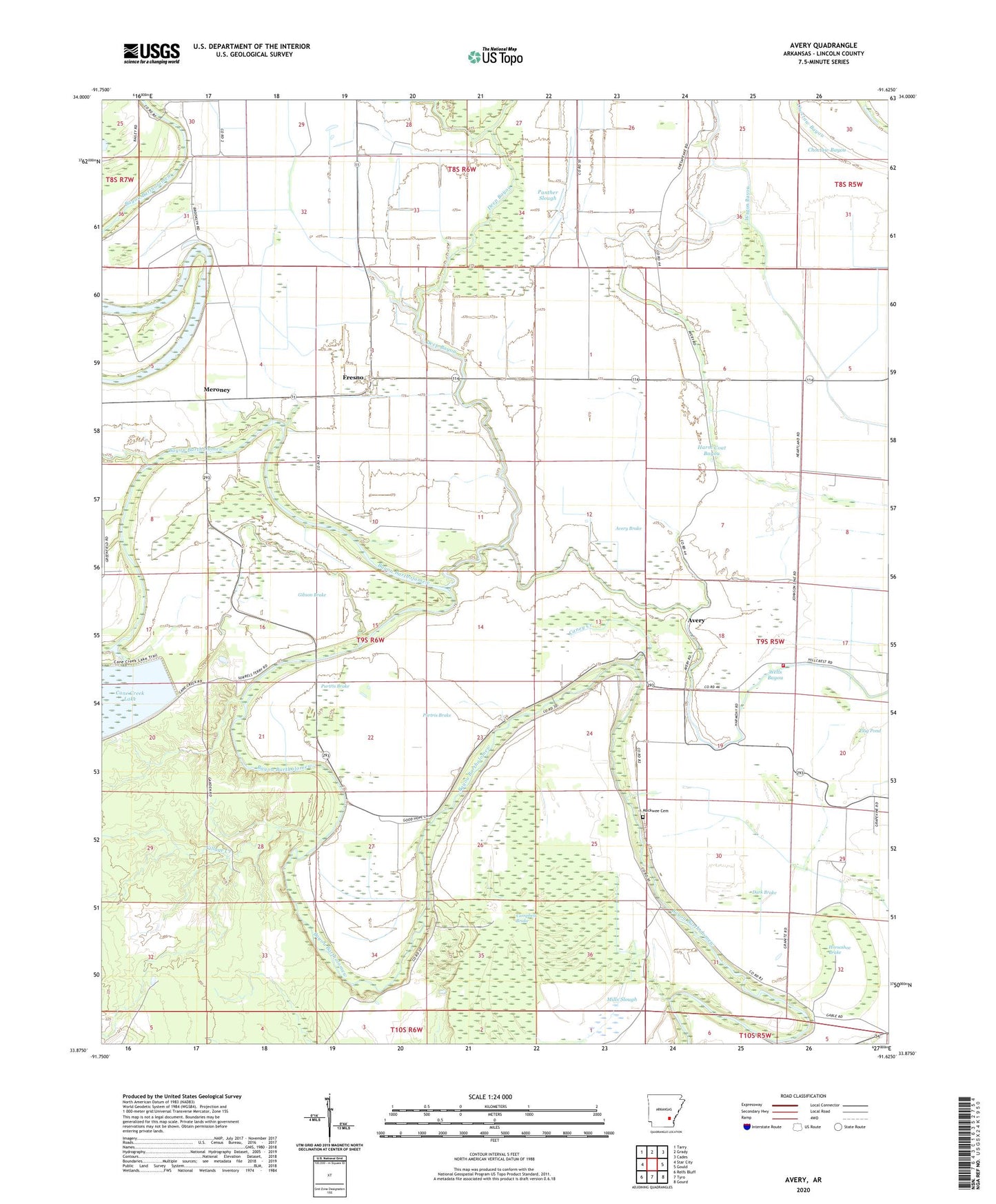
2024 topographic map quadrangle Avery in the state of Arkansas. Scale: 1:24000. Based on the newly updated USGS 7.5' US Topo map series, this map is in the following counties: Lincoln. The map contains contour data, water features, and other items you are used to seeing on USGS maps, but also has updated roads and other features. This is the next generation of topographic maps. Printed on high-quality waterproof paper with UV fade-resistant inks.
Quads adjacent to this one:
West: Star City
Northwest: Tarry
North: Grady
Northeast: Cades
East: Gould
Southeast: Gourd
South: Tyro
Southwest: Relfs Bluff
This map covers the same area as the classic USGS quad with code o33091h6.
Contains the following named places: Avery, Avery Brake, Cane Creek, Caney Creek, Champion, Coles Spur, Cypress Grove Church, Dark Brake, Deep Bayou, Flag Pond, Fresno, Gibson Brake, Harm Coat Bayou, Horseshoe Brake, Liberty Church, Lincoln County, Mackwee Cemetery, Mackwee Church, Mattox Ferry, Mattox Ford, Meroney, Mills Slough, Mount Olive Church, New Bethel Church, Panther Slough, Persons Bridge, Persons Bridge School, Persons Chapel, Persons Chapel School, Pinchback Reservoir, Price Brake, Purtris Brake, Rankin Chapel Baptist Church, Rose Hill, Rose Hill Church, Saint Harmony Church, Saint James Church, Shooks Reservoir, Village Creek, Wagon Bayou, Wells Bayou School, Wells Bayou Volunteer Fire Department