MyTopo
Humphrey SW Arkansas US Topo Map
Couldn't load pickup availability
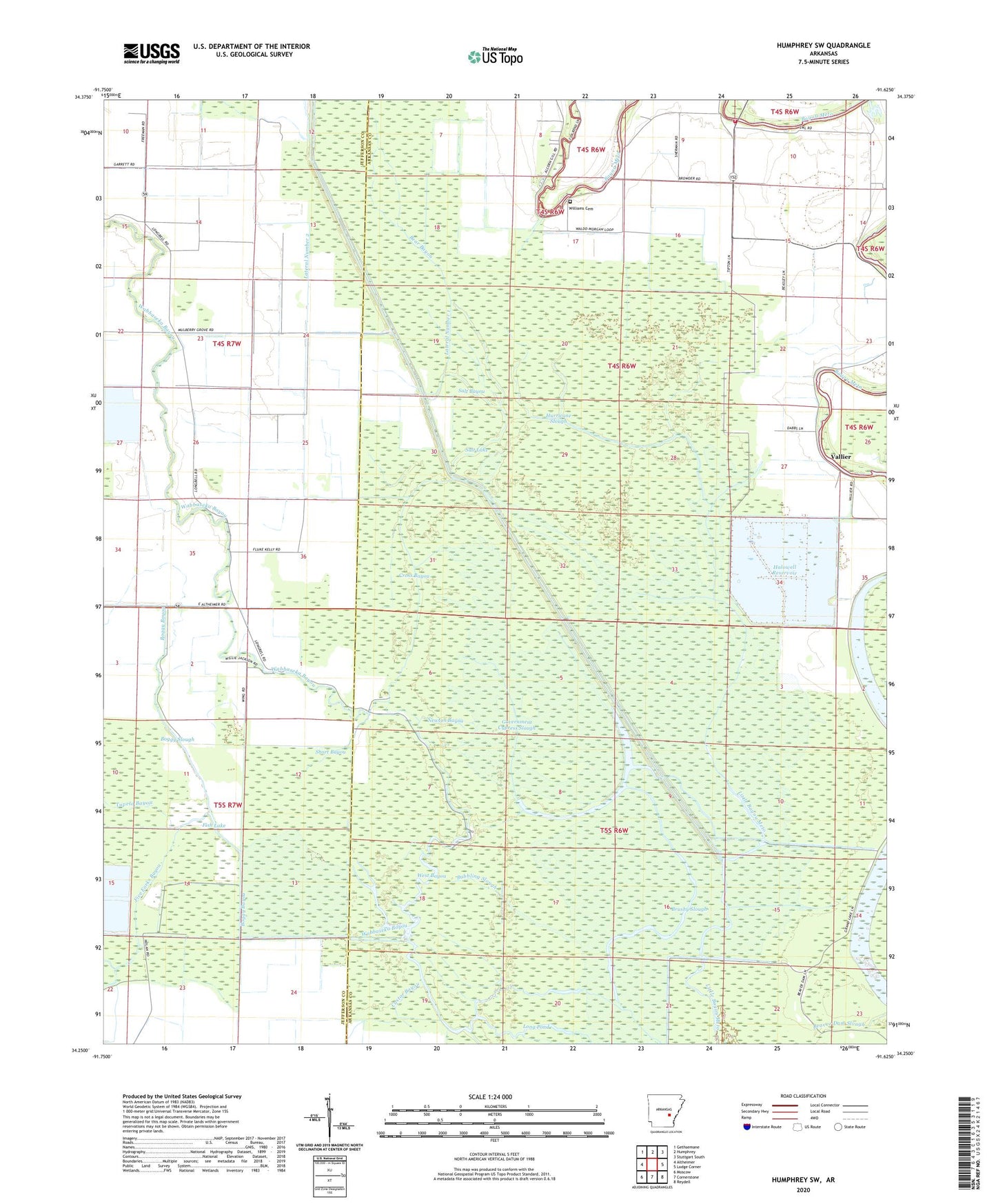
2024 topographic map quadrangle Humphrey SW in the state of Arkansas. Scale: 1:24000. Based on the newly updated USGS 7.5' US Topo map series, this map is in the following counties: Arkansas, Jefferson. The map contains contour data, water features, and other items you are used to seeing on USGS maps, but also has updated roads and other features. This is the next generation of topographic maps. Printed on high-quality waterproof paper with UV fade-resistant inks.
Quads adjacent to this one:
West: Altheimer
Northwest: Gethsemane
North: Humphrey
Northeast: Stuttgart South
East: Lodge Corner
Southeast: Reydell
South: Cornerstone
Southwest: Moscow
This map covers the same area as the classic USGS quad with code o34091c6.
Contains the following named places: Alcorn Fire Station, Alcorn School, Bayou Meto Church, Bayou Meto State Game Area, Bear Bayou, Boggy Bayou, Boggy Slough, Brushy Slough, Bubbling Slough, Castor Bayou, Corinth Church, Cox Cypress Lake, Cross Bayou, Fish Lake, Five Forks Bayou, Government Cypress Slough, Grand Cypress Lake, Halowell Reservoir, Hurricane Slough, Lateral Number 1, Lateral Number 2, Lockhart School, Main Canal, Mulberry Grove Church, Mulberry Grove School, Newton Bayou, Salt Bayou, Salt Lake, Short Bayou, Star View School, Township of Barton, Township of Brewer, Tupelo Bayou, Union Grove Church, Vallier, Vallier School, Wabbaseka Bayou, West Bayou, Williams Cemetery, Williams Church