MyTopo
Grady Arkansas US Topo Map
Couldn't load pickup availability
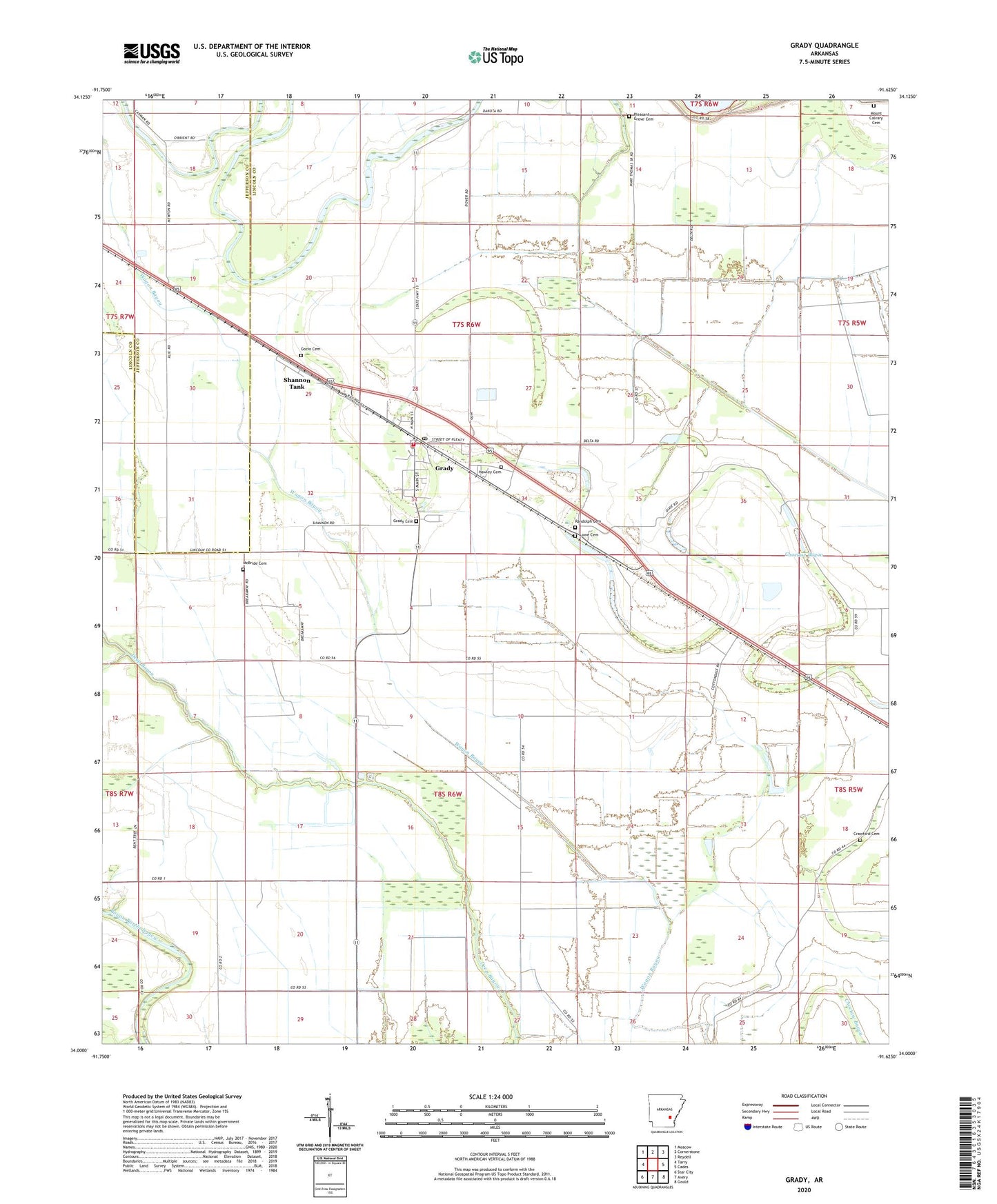
2024 topographic map quadrangle Grady in the state of Arkansas. Scale: 1:24000. Based on the newly updated USGS 7.5' US Topo map series, this map is in the following counties: Lincoln, Jefferson. The map contains contour data, water features, and other items you are used to seeing on USGS maps, but also has updated roads and other features. This is the next generation of topographic maps. Printed on high-quality waterproof paper with UV fade-resistant inks.
Quads adjacent to this one:
West: Tarry
Northwest: Moscow
North: Cornerstone
Northeast: Reydell
East: Cades
Southeast: Gould
South: Avery
Southwest: Star City
This map covers the same area as the classic USGS quad with code o34091a6.
Contains the following named places: Bethel Church, Church of God, City of Grady, Crawford Cemetery, Damascus Church, Dolton, Dorabell Church, First Baptist Church, Four Groves, Gocio Cemetery, Grady, Grady Cemetery, Grady Elementary School, Grady Fire Department, Grady High School, Grady Police Department, Grady Post Office, Grady Public Library, Hawley Cemetery, Kennedy High School, Lee School, Long Lake, Lowe Cemetery, Macedonia Church, Marzell Church, Matthews Field, McBride Cemetery, Mount Calvary Cemetery, Mount Calvary Church, Mount Pisgah Church, Mount Zion Church, New Saint James Zion Church, Palestine Church, Paradise Church, Pleasant Grove Cemetery, Pleasant Grove Church, Randolph Cemetery, Saint Pauls Church, Sarassa, Sarassa Lake, Shannon Tank, Silt, Township of Choctaw, Woodville, ZIP Code: 71644