MyTopo
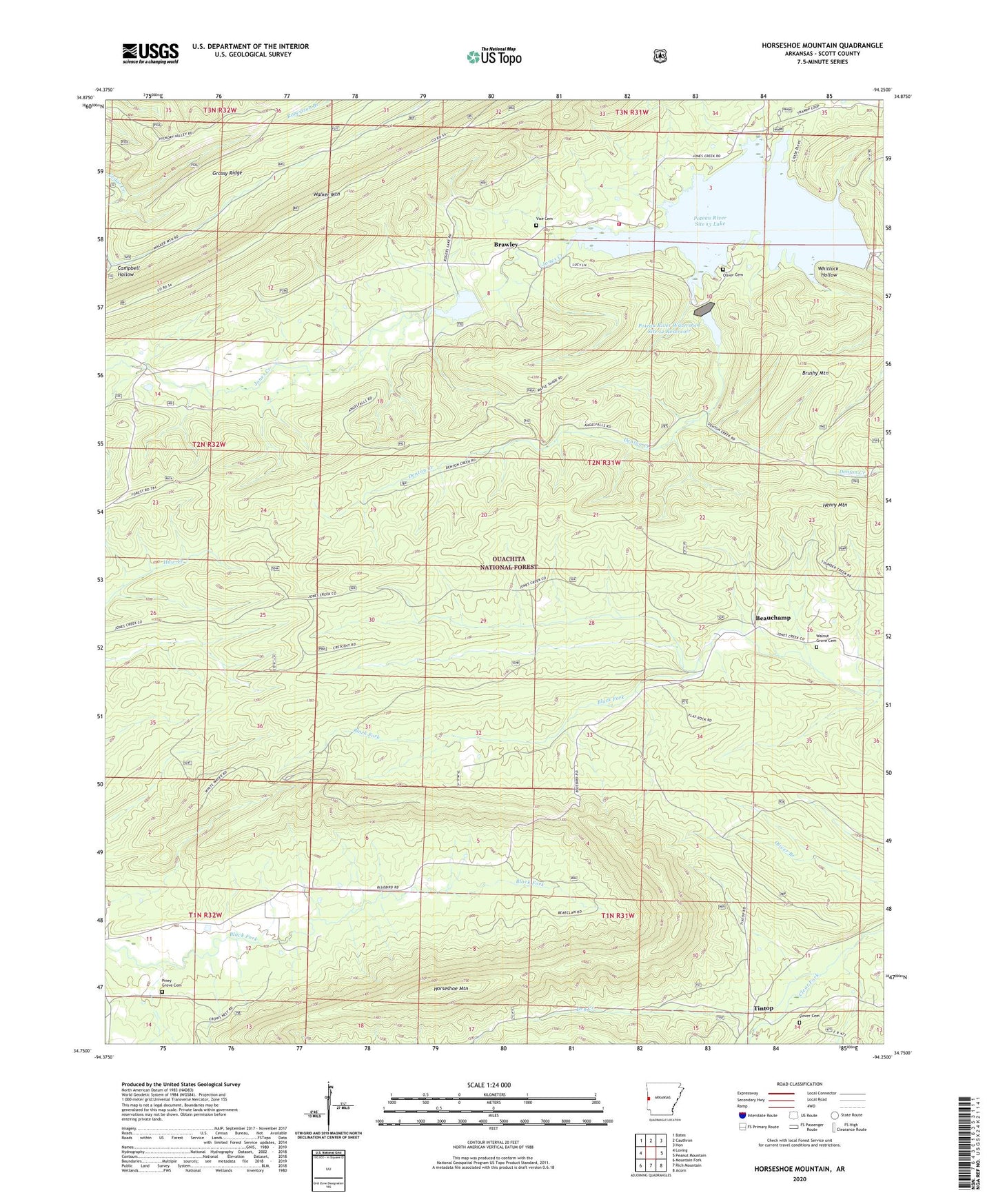
Horseshoe Mountain Arkansas US Topo Map
Couldn't load pickup availability
Also explore the Horseshoe Mountain Forest Service Topo of this same quad for updated USFS data
2024 topographic map quadrangle Horseshoe Mountain in the state of Arkansas. Scale: 1:24000. Based on the newly updated USGS 7.5' US Topo map series, this map is in the following counties: Scott. The map contains contour data, water features, and other items you are used to seeing on USGS maps, but also has updated roads and other features. This is the next generation of topographic maps. Printed on high-quality waterproof paper with UV fade-resistant inks.
Quads adjacent to this one:
West: Loving
Northwest: Bates
North: Cauthron
Northeast: Hon
East: Peanut Mountain
Southeast: Acorn
South: Rich Mountain
Southwest: Mountain Fork
This map covers the same area as the classic USGS quad with code o34094g3.
Contains the following named places: Arkansas Noname 163 Dam, Beauchamp, Beauchamp Church, Brawley, Campbell Hollow, Denton Creek, Dry Creek, Grassy Ridge, Horseshoe Mountain, Lake Hinkle, Lake Hinkle Fire Station, Little Pines Recreation Site, Multiple-Purpose Structure Number 15 Dam, Oliver Cemetery, Piney Church, Piney Grove Cemetery, Poteau River Site 11 Dam, Poteau River Site 13 Lake, Poteau River Watershed Site 11 Dam, Poteau River Watershed Site 12 Reservoir, Poteau River Watershed Site 13 Dam, Sensation, Slover Cemetery, Terrapin Creek, Tintop, Township of Brawley, Unity Church, Vise Cemetery, Walnut Grove Cemetery, Whitlock Hollow