MyTopo
Sheppard Arkansas US Topo Map
Couldn't load pickup availability
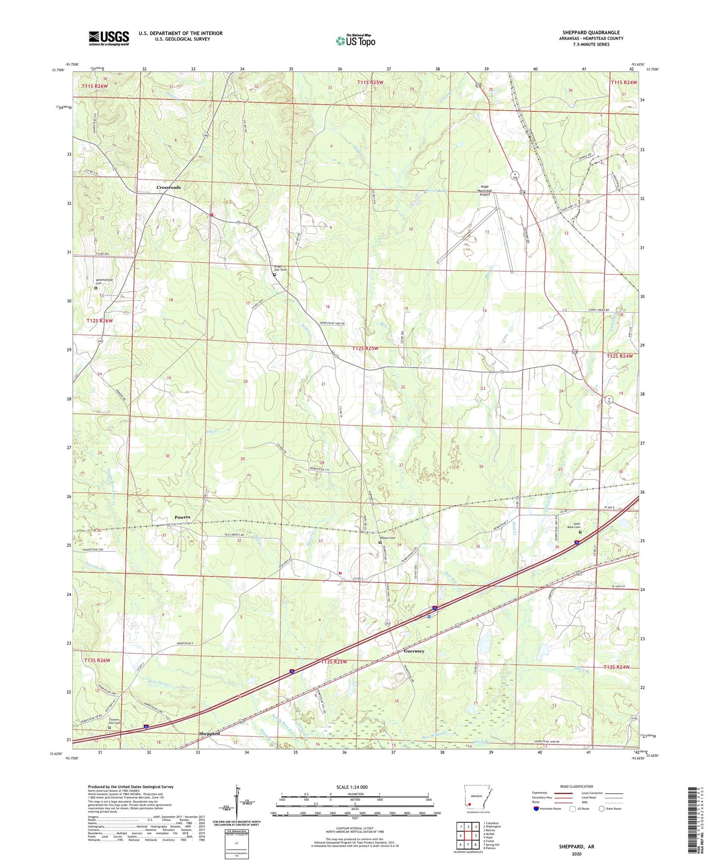
2024 topographic map quadrangle Sheppard in the state of Arkansas. Scale: 1:24000. Based on the newly updated USGS 7.5' US Topo map series, this map is in the following counties: Hempstead. The map contains contour data, water features, and other items you are used to seeing on USGS maps, but also has updated roads and other features. This is the next generation of topographic maps. Printed on high-quality waterproof paper with UV fade-resistant inks.
Quads adjacent to this one:
West: McNab
Northwest: Columbus
North: Washington
Northeast: Blevins
East: Hope
Southeast: Patmos
South: Spring Hill
Southwest: Fulton
This map covers the same area as the classic USGS quad with code o33093f6.
Contains the following named places: Arkansas Highway Police Hope, Black Branch, Bright Star Cemetery, Bright Star School, Brown Chapel, Caney Creek, Crossroads, Crossroads Volunteer Fire Department, Dolph, Flat Creek, Flowers Hill Cemetery, Guernsey, Guernsey Baptist Church, Guernsey High School, Guernsey School, Guernsey Volunteer Fire Department, Hempstead County, High Creek, Hope Municipal Airport, Liberty Church, Liberty School, Mount Hebron Church, Mount Sinai Church, Mud Creek, Porter Lake, Porter Lake Dam, Powers, Saint Luke Number 2 Missionary Baptist Church, Saint Mark Cemetery, Saint Mark Church, Sheppard, Southwestern Proving Ground, Southwestern Proving Ground Airport Historic District, Town Creek, Township of Water Creek, Wafers Crossing, Water Creek, Water Creek Church, Wayne Chapel, Westmorland Cemetery, Wilson Cemetery