MyTopo
McNab Arkansas US Topo Map
Couldn't load pickup availability
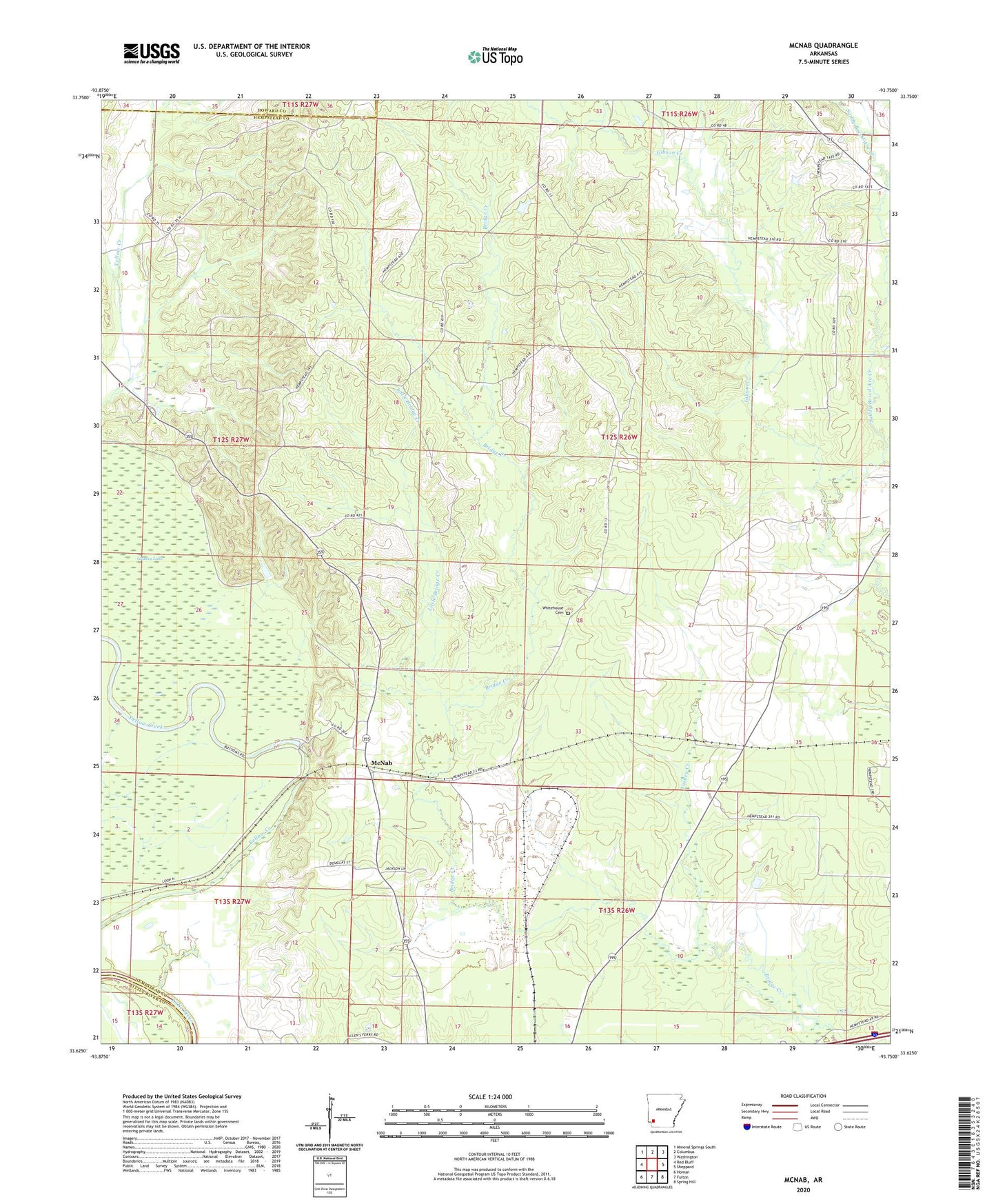
2024 topographic map quadrangle McNab in the state of Arkansas. Scale: 1:24000. Based on the newly updated USGS 7.5' US Topo map series, this map is in the following counties: Hempstead, Little River, Howard. The map contains contour data, water features, and other items you are used to seeing on USGS maps, but also has updated roads and other features. This is the next generation of topographic maps. Printed on high-quality waterproof paper with UV fade-resistant inks.
Quads adjacent to this one:
West: Red Bluff
Northwest: Mineral Springs South
North: Columbus
Northeast: Washington
East: Sheppard
Southeast: Spring Hill
South: Fulton
Southwest: Homan
This map covers the same area as the classic USGS quad with code o33093f7.
Contains the following named places: Camp Spring, Church Hill Church, Douglas School, Gibson Creek, Grassy Lake, Gravel Hill Church, Hempstead Country Hunting Club, John W Turk Jr Power Plant, Little Bridge Creek, Mars Hill Church, McNab, Mount Pleasant Church, Thrasher, Town of McNab, Township of Bois d'Arc, Township of Saline, Turkey Creek, Whitehouse Cemetery, Yellow Creek Church, Zion Hill Church, ZIP Code: 71838