MyTopo
Sparkman Arkansas US Topo Map
Couldn't load pickup availability
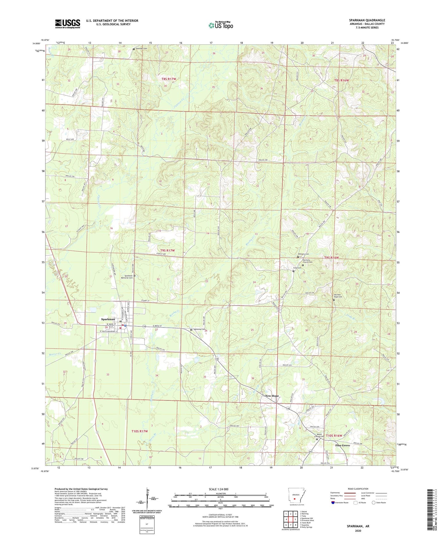
2024 topographic map quadrangle Sparkman in the state of Arkansas. Scale: 1:24000. Based on the newly updated USGS 7.5' US Topo map series, this map is in the following counties: Dallas. The map contains contour data, water features, and other items you are used to seeing on USGS maps, but also has updated roads and other features. This is the next generation of topographic maps. Printed on high-quality waterproof paper with UV fade-resistant inks.
Quads adjacent to this one:
West: Sparkman NW
Northwest: Dalark
North: Manning
Northeast: Tulip
East: Princeton West
Southeast: Holly Springs
South: Ouachita
Southwest: Tates Bluff
This map covers the same area as the classic USGS quad with code o33092h7.
Contains the following named places: City of Sparkman, Ebenezer Church, Erby Cemetery, First Baptist Church, Harmony Church Cemetery, Holeman Cemetery, Horse Branch, Key Hill Lookout Tower, Macedonia Church, Mount Carmel Cemetery, New Hope, New Hope Baptist Church, Old New Hope Cemetery, Pine Grove, Sardis Methodist Church, Shady Grove Baptist Church, Sparkman, Sparkman Cemetery, Sparkman Elementary School, Sparkman Fire Department, Sparkman Fire Station Old Station, Sparkman High School, Sparkman Memorial Cemetery, Sparkman Police Department, Sparkman Post Office, Township of Nix, Township of Owen, Williams Cemetery, ZIP Code: 71763