MyTopo
Tates Bluff Arkansas US Topo Map
Couldn't load pickup availability
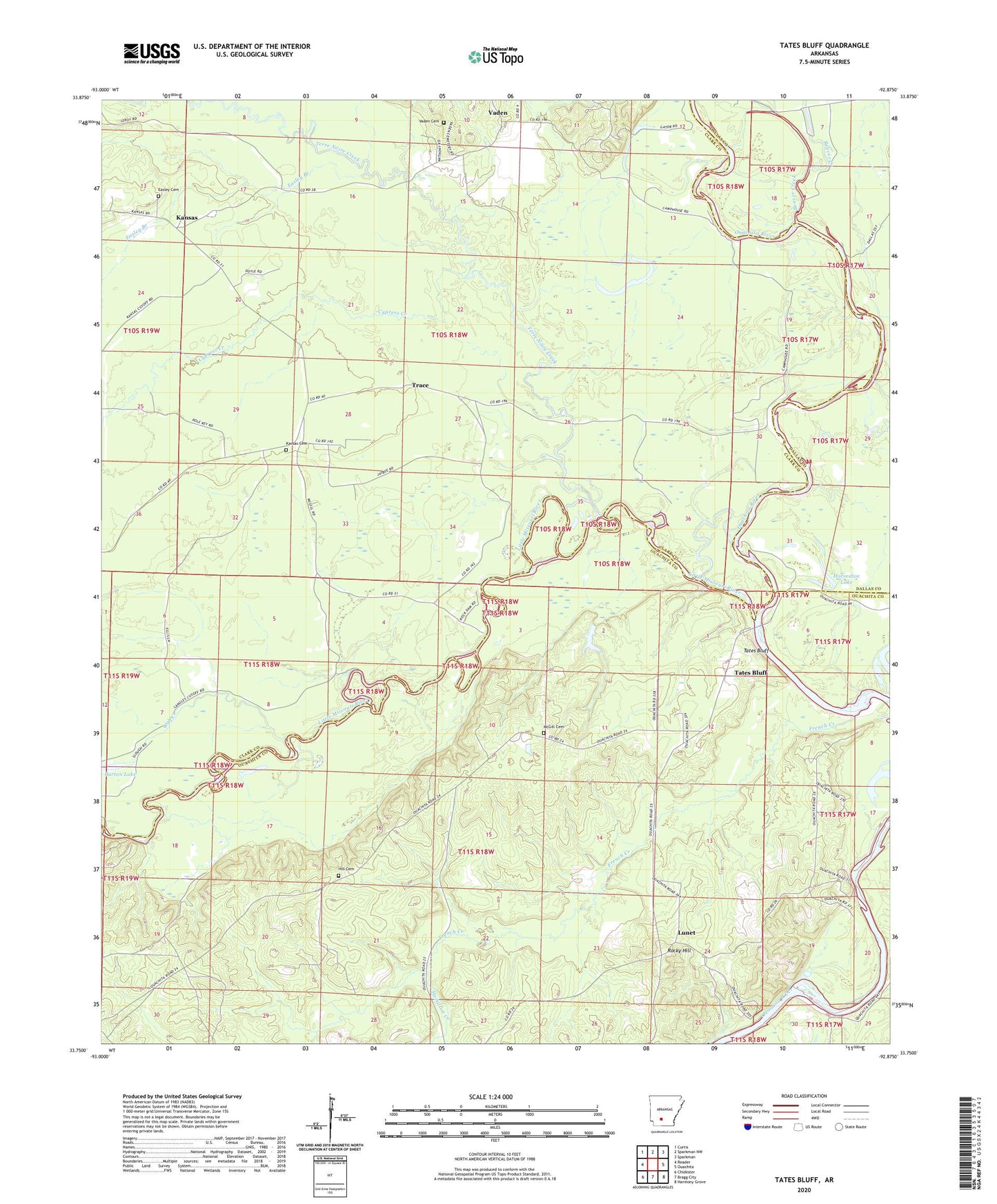
2024 topographic map quadrangle Tates Bluff in the state of Arkansas. Scale: 1:24000. Based on the newly updated USGS 7.5' US Topo map series, this map is in the following counties: Clark, Ouachita, Dallas. The map contains contour data, water features, and other items you are used to seeing on USGS maps, but also has updated roads and other features. This is the next generation of topographic maps. Printed on high-quality waterproof paper with UV fade-resistant inks.
Quads adjacent to this one:
West: Reader
Northwest: Curtis
North: Sparkman NW
Northeast: Sparkman
East: Ouachita
Southeast: Harmony Grove
South: Bragg City
Southwest: Chidester
This map covers the same area as the classic USGS quad with code o33092g8.
Contains the following named places: Bacon Lake, Barton Lake, Beaver Creek, Brushy Creek, Church of God, Cypress Creek, Easley Branch, Easley Cemetery, French Creek, Hamilton Creek, Hill Cemetery, Horseshoe Lake, Kansas, Kansas Cemetery, Kansas Community Volunteer Fire Department, Little Missouri River, Lunet, McGill Cemetery, Providence Church, Rocky Hill, Rocky Hill Church, Rucks Landing, Tates Bluff, Tates Bluff Church, Terre Noire Creek, Trace, Union Church, Vaden, Vaden Cemetery, Vaden Church, Wolf Creek