MyTopo
Spotville Arkansas US Topo Map
Couldn't load pickup availability
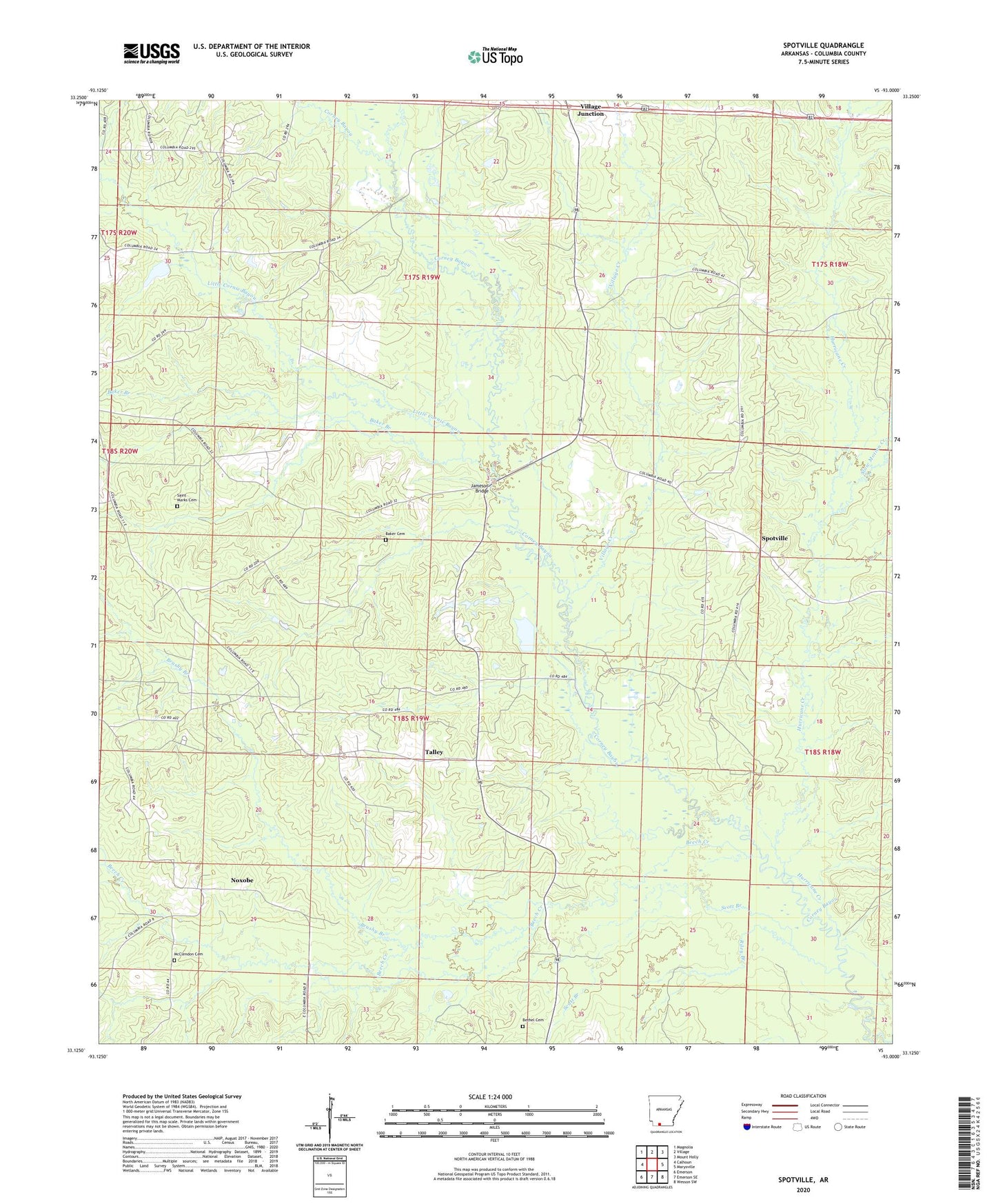
2024 topographic map quadrangle Spotville in the state of Arkansas. Scale: 1:24000. Based on the newly updated USGS 7.5' US Topo map series, this map is in the following counties: Columbia. The map contains contour data, water features, and other items you are used to seeing on USGS maps, but also has updated roads and other features. This is the next generation of topographic maps. Printed on high-quality waterproof paper with UV fade-resistant inks.
Quads adjacent to this one:
West: Calhoun
Northwest: Magnolia
North: Village
Northeast: Mount Holly
East: Marysville
Southeast: Wesson SW
South: Emerson SE
Southwest: Emerson
This map covers the same area as the classic USGS quad with code o33093b1.
Contains the following named places: Atlanta Oil and Gas Field, Baker Branch, Baker Cemetery, Beech Creek, Bethel Cemetery, Bethel Church, Bethlehem Church, Brushy Branch, Church of Christ, Harper Creek, Heard Chapel, Hurricane Creek, Jameson Bridge, Little Cornie Bayou, McClendon Cemetery, Nebo School, Noxobe, Pine Tree Oil and Gas Field, Riley Branch, Saint Marks Cemetery, Saint Marks Church, Scott Branch, Slow Motion Creek, Smyrna Church, Spotville, Spotville School, Talley, Talley School, Tanyard Branch, Township of Calhoun, Township of Cornie, Village Creek, Village Junction, Zion Church