MyTopo
Emerson SE Arkansas US Topo Map
Couldn't load pickup availability
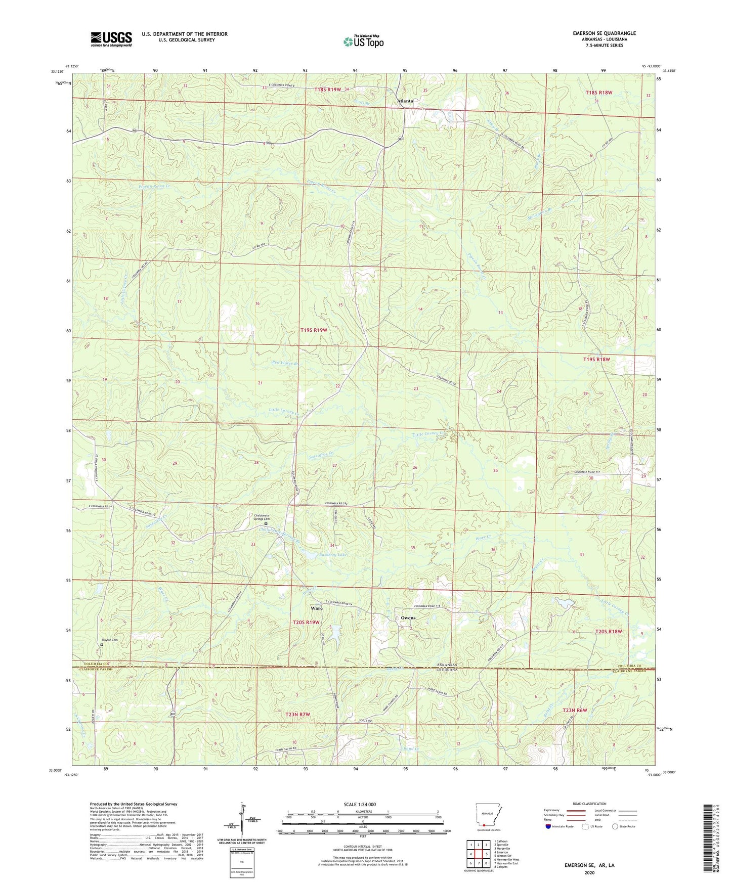
2024 topographic map quadrangle Emerson SE in the states of Arkansas, Louisiana. Scale: 1:24000. Based on the newly updated USGS 7.5' US Topo map series, this map is in the following counties: Columbia, Claiborne. The map contains contour data, water features, and other items you are used to seeing on USGS maps, but also has updated roads and other features. This is the next generation of topographic maps. Printed on high-quality waterproof paper with UV fade-resistant inks.
Quads adjacent to this one:
West: Emerson
Northwest: Calhoun
North: Spotville
Northeast: Marysville
East: Wesson SW
Southeast: Colquitt
South: Haynesville East
Southwest: Haynesville West
Contains the following named places: Atlanta, Beene Creek, Calico Neck, Calico Neck School, Chalybeate Springs Branch, Chalybeate Springs Cemetery, Chalybeate Springs Church, East Haynesville Oil and Gas Field, Mount Bethel Church, Mount Israel Church, Mount Pleasant School, New Hope Number 1 Church, Owens, Piney Grove Church, Rasberry Lake, Rasberry Lake Dam, Red Water Branch, Roadside Church, Sassafras Creek, Sobers Chapel, Township of Brown, Traylor Cemetery, Ware, Ware Creek, Wares Chapel United Methodist Church, Woodward Chapel