MyTopo
Emerson Arkansas US Topo Map
Couldn't load pickup availability
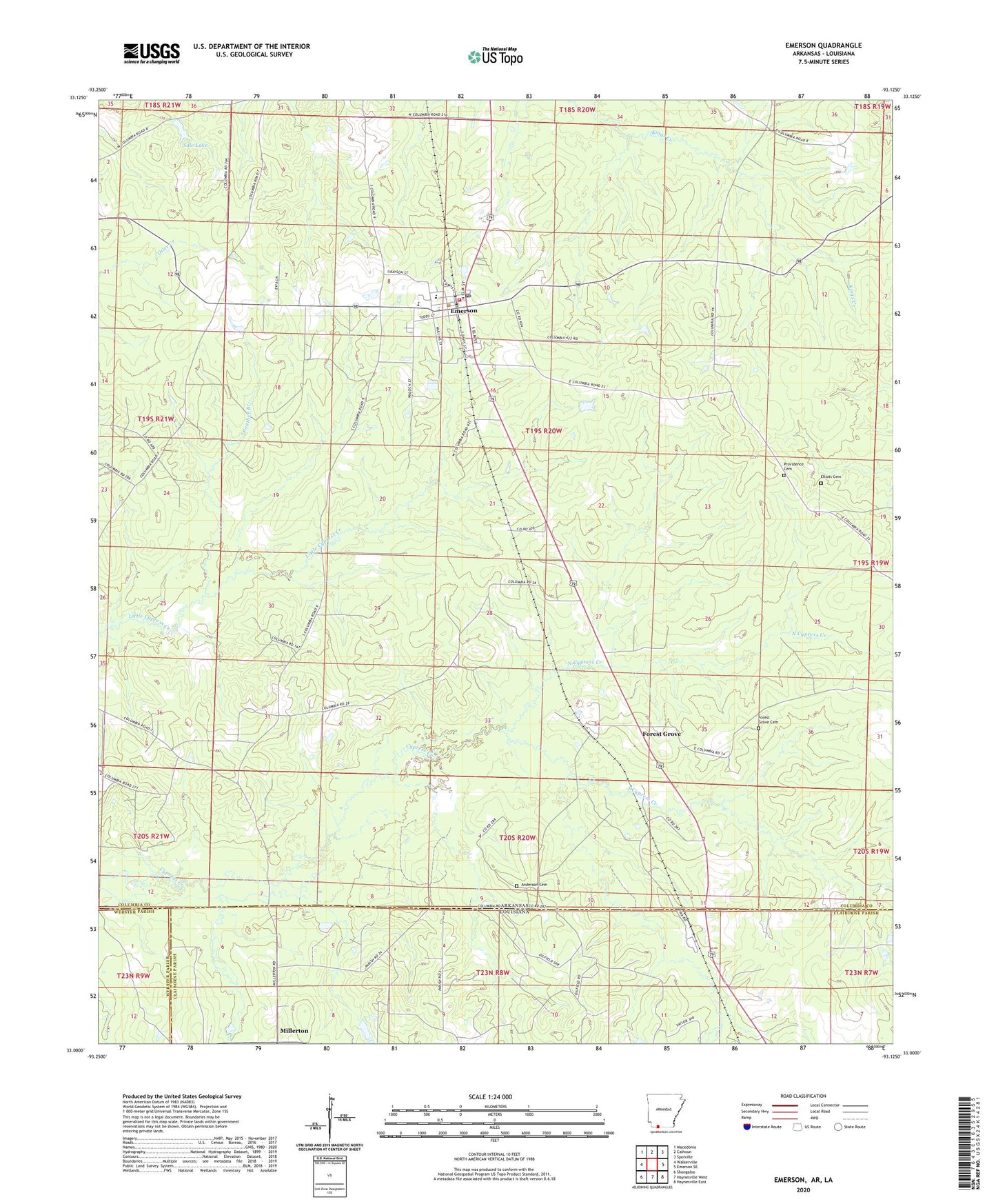
2024 topographic map quadrangle Emerson in the states of Arkansas, Louisiana. Scale: 1:24000. Based on the newly updated USGS 7.5' US Topo map series, this map is in the following counties: Columbia, Claiborne, Webster. The map contains contour data, water features, and other items you are used to seeing on USGS maps, but also has updated roads and other features. This is the next generation of topographic maps. Printed on high-quality waterproof paper with UV fade-resistant inks.
Quads adjacent to this one:
West: Walkerville
Northwest: Macedonia
North: Calhoun
Northeast: Spotville
East: Emerson SE
Southeast: Haynesville East
South: Haynesville West
Southwest: Shongaloo
Contains the following named places: Anderson Cemetery, Canaan Land Church, Cross Roads Church, Elliott Cemetery, Emerson, Emerson Church, Emerson Elementary School, Emerson High School, Emerson Post Office, Emerson Volunteer Fire Department, Forest Grove, Forest Grove Cemetery, Forest Grove Church, Haynesville Oil Field, Hopewell School, Horsehead Oil Field, Millerton, Mohawk, Mount Pisgah United Methodist Church, Mount Pleasant Church, Mount Pleasant School, North Cypress Creek, Panther Branch, Pine Hill Church, Pisgah School, Pleasant Home Church, Providence Cemetery, Providence Church, Rucks Spur, Sale Lake, Sale Lake Dam, Soco, South Cypress Creek, State Line, State Line School, Sweet Home Church, Town of Emerson, Township of Emerson, Township of Moss, Wood School, ZIP Code: 71740