MyTopo
Calhoun Arkansas US Topo Map
Couldn't load pickup availability
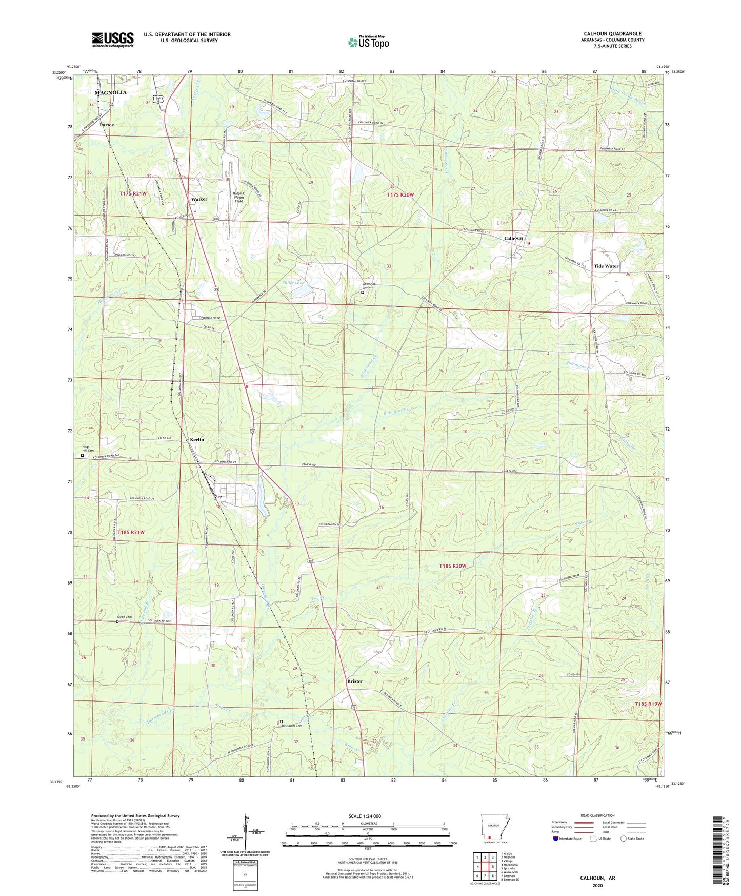
2024 topographic map quadrangle Calhoun in the state of Arkansas. Scale: 1:24000. Based on the newly updated USGS 7.5' US Topo map series, this map is in the following counties: Columbia. The map contains contour data, water features, and other items you are used to seeing on USGS maps, but also has updated roads and other features. This is the next generation of topographic maps. Printed on high-quality waterproof paper with UV fade-resistant inks.
Quads adjacent to this one:
West: Macedonia
Northwest: Waldo
North: Magnolia
Northeast: Village
East: Spotville
Southeast: Emerson SE
South: Emerson
Southwest: Walkerville
This map covers the same area as the classic USGS quad with code o33093b2.
Contains the following named places: Antioch Church, Brister, Calhoun, Calhoun Community Volunteer Fire Department, Calhoun Oil and Gas Field, Christie Chapel United Methodist Church, Christies Branch, Columbia County, Columbia Oil and Gas Field, Cross Roads School, Dry Creek, Harvey Couch High School, Highway 79 South Fire Department, Honduras Branch, Jerusalem Cemetery, Kerlin, Kings Creek, Kings Hill Cemetery, Kings Hill Church, Macedonia Church, Magnolia Country Club, Magnolia Oil and Gas Field, Memorial Gardens, Miller Lake, Miller Lake Dam, Mount Carmel Church, Mount Zion Church, Owen Cemetery, Partee, Pine Forest School, Ralph C Weiser Field, Saint Lukes Church, Saint Marks Church, Tide Water, Township of Brister, Union Church, Valley School, Walker, Walker Elementary School, Walker High School, Walker Pre - Kindergarten Center, Walkers School, White Oak Branch, Wilburn School, Wingfield Church, ZIP Code: 71753