MyTopo
Stephens Arkansas US Topo Map
Couldn't load pickup availability
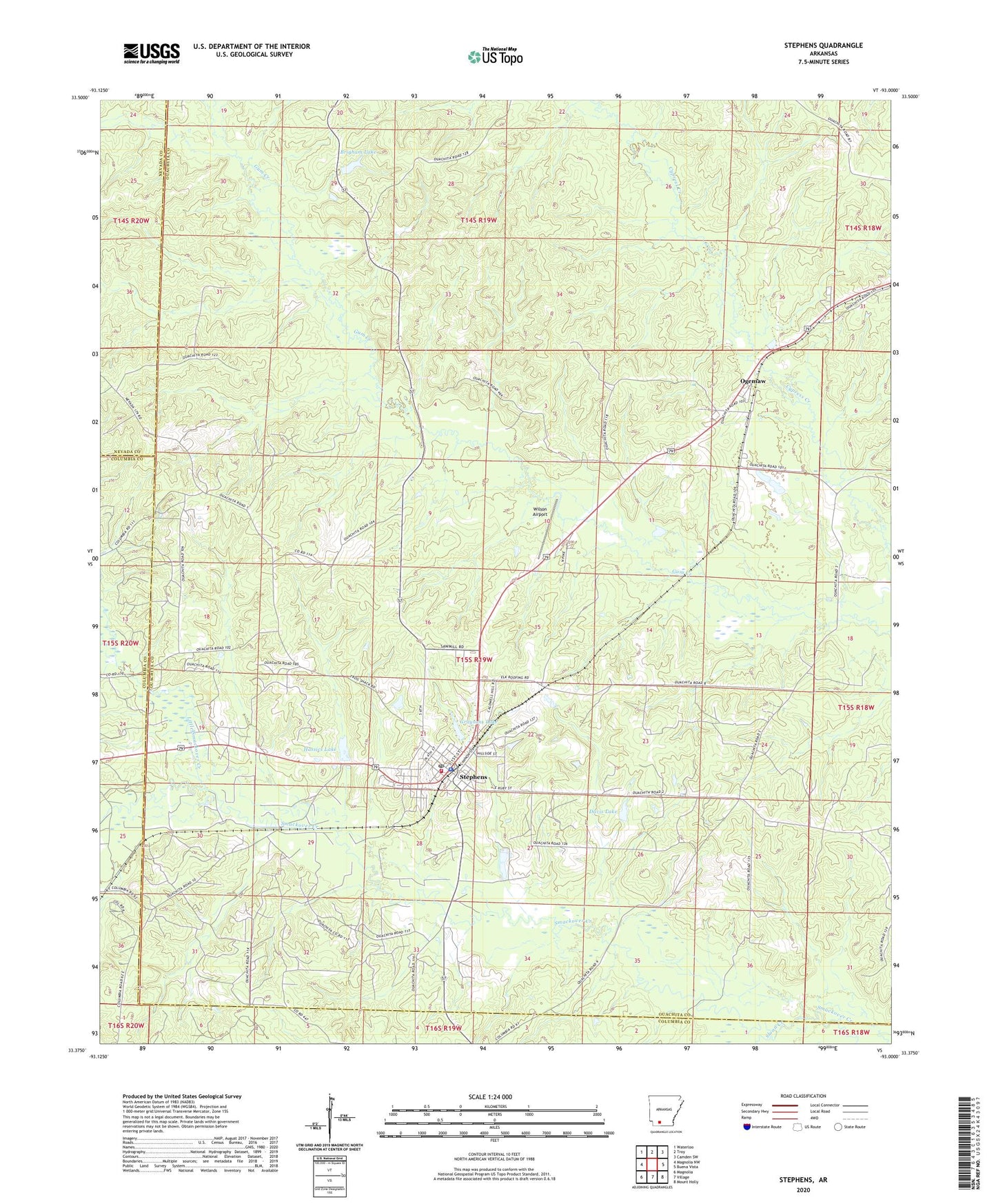
2024 topographic map quadrangle Stephens in the state of Arkansas. Scale: 1:24000. Based on the newly updated USGS 7.5' US Topo map series, this map is in the following counties: Ouachita, Columbia, Nevada. The map contains contour data, water features, and other items you are used to seeing on USGS maps, but also has updated roads and other features. This is the next generation of topographic maps. Printed on high-quality waterproof paper with UV fade-resistant inks.
Quads adjacent to this one:
West: Magnolia NW
Northwest: Waterloo
North: Troy
Northeast: Camden SW
East: Buena Vista
Southeast: Mount Holly
South: Village
Southwest: Magnolia
This map covers the same area as the classic USGS quad with code o33093d1.
Contains the following named places: Brigham Lake, Brigham Lake Dam, Carver School, Cedar Grove Church, City of Stephens, Curry Oil and Gas Field, Davis Lake, Davis Lake Dam, Graysons Dam, Graysons Lake, Hassics Dam, Hassics Lake, Little Smackover Creek, New Home Church, New Zion Hill Church, Ogemaw, Seminary Church, Sloan Creek, Smart Oil and Gas Field, Stephens, Stephens Ambulance, Stephens Elementary School, Stephens Fire Department, Stephens High School, Stephens Oil and Gas Field, Stephens Police Department, Stephens Post Office, Township of Smackover, Wesson North Oil and Gas Field, Wesson Oil and Gas Field, Wilson Airport, ZIP Code: 71764