MyTopo
Waterloo Arkansas US Topo Map
Couldn't load pickup availability
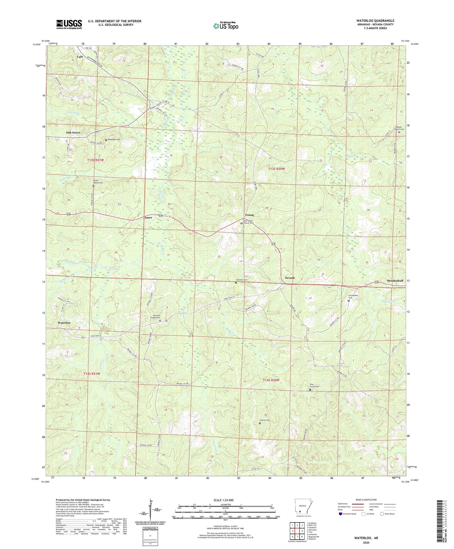
2024 topographic map quadrangle Waterloo in the state of Arkansas. Scale: 1:24000. Based on the newly updated USGS 7.5' US Topo map series, this map is in the following counties: Nevada. The map contains contour data, water features, and other items you are used to seeing on USGS maps, but also has updated roads and other features. This is the next generation of topographic maps. Printed on high-quality waterproof paper with UV fade-resistant inks.
Quads adjacent to this one:
West: Willisville
Northwest: Laneburg
North: Bluff City
Northeast: Chidester
East: Troy
Southeast: Stephens
South: Magnolia NW
Southwest: Lamartine
This map covers the same area as the classic USGS quad with code o33093e2.
Contains the following named places: Ames, Anthony Switch, Barksdale Cemetery, Black Branch, Black Creek, Brushy Creek, Cana Church, Caney, Carolina Methodist Church, Carolina School, Christopher Cemetery, Dry Fork, Harrison Chapel, Harrison Chapel Cemetery, Hearon Cemetery, Hopewell School, Irma Oil Field, Lebanon Cemetery, Mendenhall, Nevark, New Salem Church, New Salem Church Cemetery, Oak Grove, Oak Grove School, Pine Grove Cemetery, Pine Grove Church, Pine Grove School, Rocky Mound Cemetery, Sanders Creek, Tidwell Branch, Township of Jackson, Township of Leake, Troy Oil Field, Waterloo, White Church Cemetery, Williams Creek, Young