MyTopo
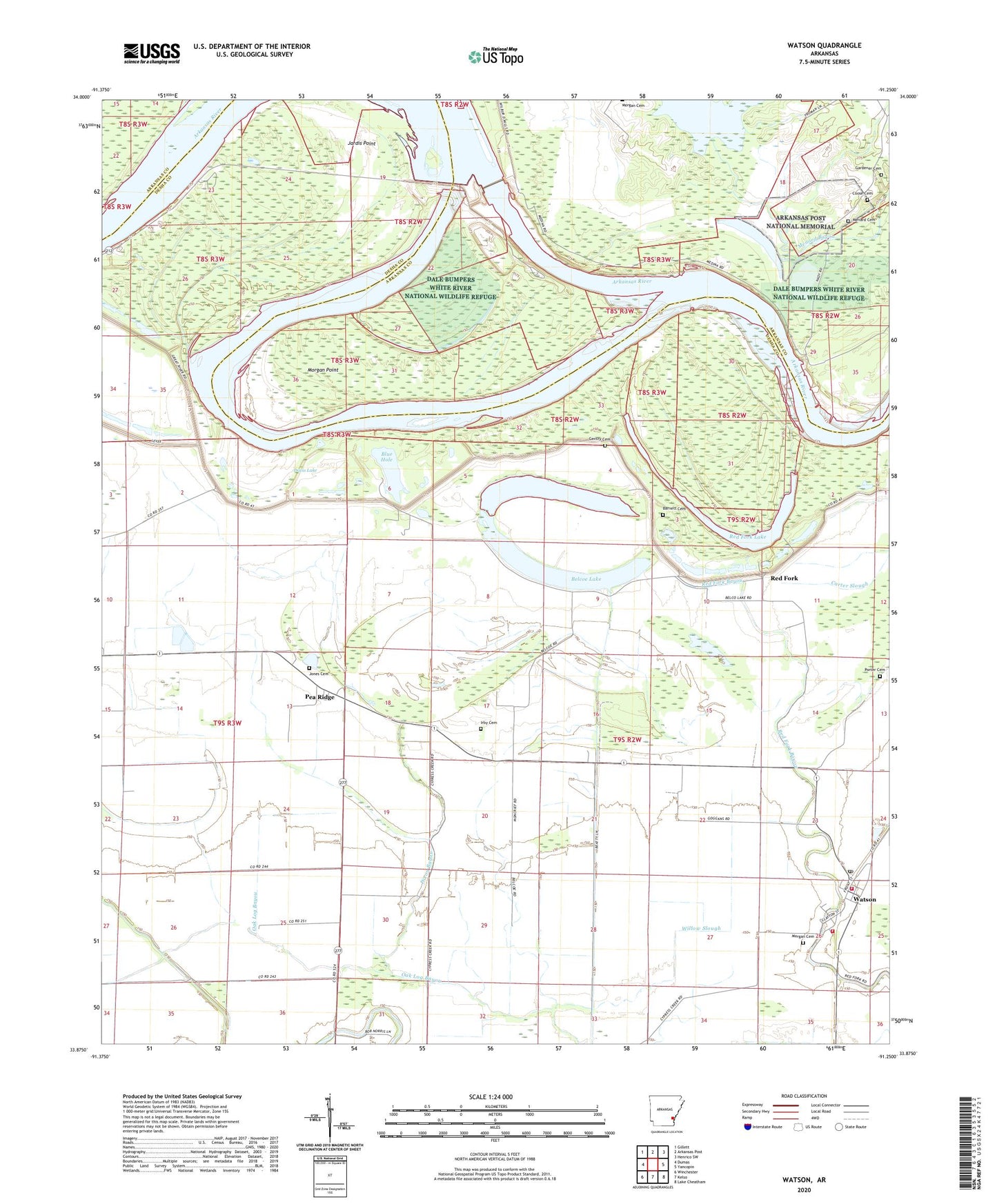
Watson Arkansas US Topo Map
Couldn't load pickup availability
2024 topographic map quadrangle Watson in the state of Arkansas. Scale: 1:24000. Based on the newly updated USGS 7.5' US Topo map series, this map is in the following counties: Desha, Arkansas. The map contains contour data, water features, and other items you are used to seeing on USGS maps, but also has updated roads and other features. This is the next generation of topographic maps. Printed on high-quality waterproof paper with UV fade-resistant inks.
Quads adjacent to this one:
West: Dumas
Northwest: Gillett
North: Arkansas Post
Northeast: Henrico SW
East: Yancopin
Southeast: Lake Cheatham
South: Kelso
Southwest: Winchester
This map covers the same area as the classic USGS quad with code o33091h3.
Contains the following named places: Barnett Cemetery, Belcoe Lake, Blue Hole, Choctaw Village, City of Watson, Coose - Menard Cemetery, Dam Number 2, Davis Lake, Dixon Bayou, Gardener Cemetery, Gentry Cemetery, Irby Cemetery, Jardis Point, Jerusalem Church, Jones Cemetery, Lake Dumond, Little Zion Church, Medford, Menard Cemetery, Morgan Cemetery, Morgan Point, Morgan Point Recreation Area, Morning Star Church, Nady Church, Notrebes Bend Recreation Area, Oak Log Bayou, Osotouy, Pea Ridge, Pendleton Recreation Area, Pool Two, Porter Cemetery, Red Fork, Red Fork Lake, Saint John Church, Township of Red Fork, Watson, Watson Post Office, Watson Volunteer Fire Department Station 1, Watson Volunteer Fire Station 2, Willow Slough