MyTopo
Wattensaw Arkansas US Topo Map
Couldn't load pickup availability
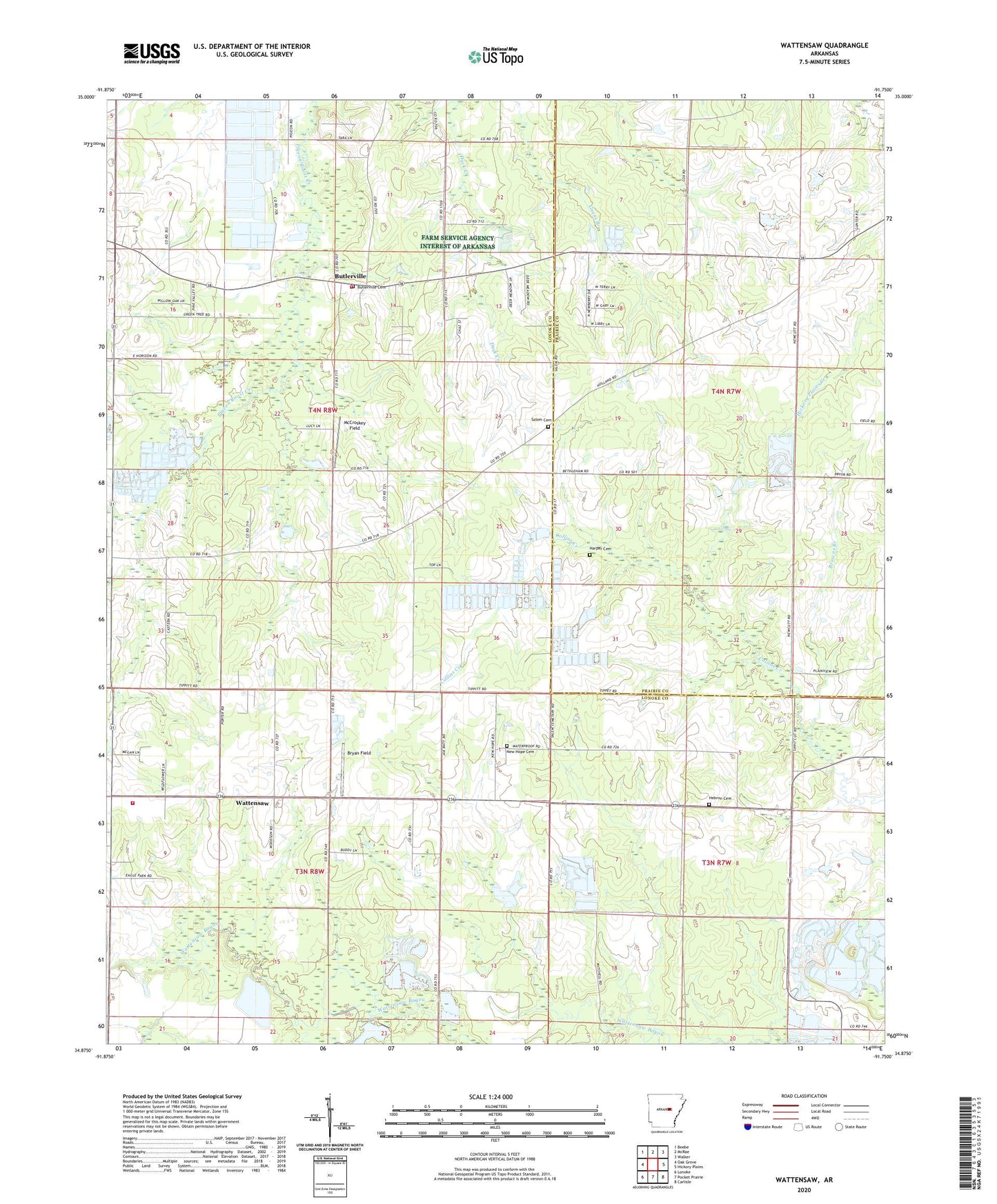
2024 topographic map quadrangle Wattensaw in the state of Arkansas. Scale: 1:24000. Based on the newly updated USGS 7.5' US Topo map series, this map is in the following counties: Lonoke, Prairie. The map contains contour data, water features, and other items you are used to seeing on USGS maps, but also has updated roads and other features. This is the next generation of topographic maps. Printed on high-quality waterproof paper with UV fade-resistant inks.
Quads adjacent to this one:
West: Oak Grove
Northwest: Beebe
North: McRae
Northeast: Walker
East: Hickory Plains
Southeast: Carlisle
South: Pocket Prairie
Southwest: Lonoke
This map covers the same area as the classic USGS quad with code o34091h7.
Contains the following named places: Bethlehem Church, Bethlehem School, Browns Branch, Bryan Field, Butlerville, Butlerville Cemetery, Butlerville Volunteer Fire Department, Eagle Park, Harper Cemetery, Hebron Cemetery, Hebron Church, Hickory Grove School, Jackson Store, Jacksons Store, Macedonia Church, McCroskey Field, New Hope Cemetery, New Hope Church, New Horizon Church, Oakdale Church, Oakdale School, Pittman School, Providence Church, Salem Cemetery, Sunnyside Church, Swan Lake, Thurman, Thurman School, Township of Butler, Township of Prairie, Township of Totten, Tri - Community Volunteer Fire Department Station 2, Waterproof, Wattensaw, Woodlawn, Woodlawn School