MyTopo
McRae Arkansas US Topo Map
Couldn't load pickup availability
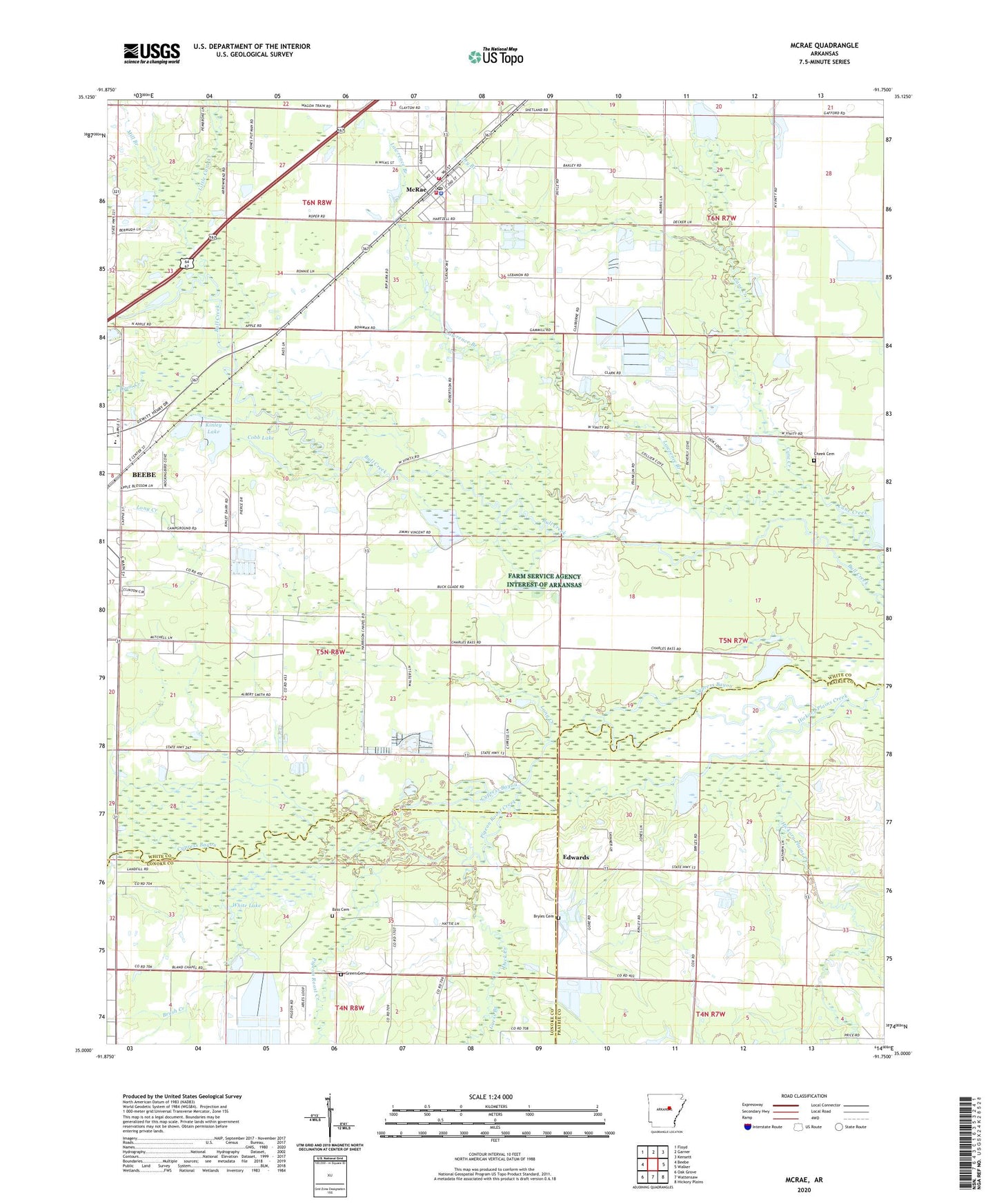
2024 topographic map quadrangle McRae in the state of Arkansas. Scale: 1:24000. Based on the newly updated USGS 7.5' US Topo map series, this map is in the following counties: White, Prairie, Lonoke. The map contains contour data, water features, and other items you are used to seeing on USGS maps, but also has updated roads and other features. This is the next generation of topographic maps. Printed on high-quality waterproof paper with UV fade-resistant inks.
Quads adjacent to this one:
West: Beebe
Northwest: Floyd
North: Garner
Northeast: Kensett
East: Walker
Southeast: Hickory Plains
South: Wattensaw
Southwest: Oak Grove
This map covers the same area as the classic USGS quad with code o35091a7.
Contains the following named places: Bass Cemetery, Bland School, Brush Creek, Bryles Cemetery, Cheek Cemetery, City of McRae, Cobb Lake, Cypress Lake, David Chapel, Dry Branch, Duck Creek, Edwards, Green Cemetery, Guess Branch, Gum Creek, Harrison Chapel, Hickory Plains Creek, Kinley Lake, Kinley Lake Dam, Lawrence Branch, Lebanon Church, Little Cane Creek, Long Creek, McRae, McRae Elementary School, McRae Fire Department Station 2, Mcrae High School, McRae High School, McRae Police Department, McRae Post Office, McRae Volunteer Fire Department, Mill Branch, Pigeon Roost Creek, Red Cut Slough, Township of Garner, Township of McRae, White Lake, ZIP Code: 72176