MyTopo
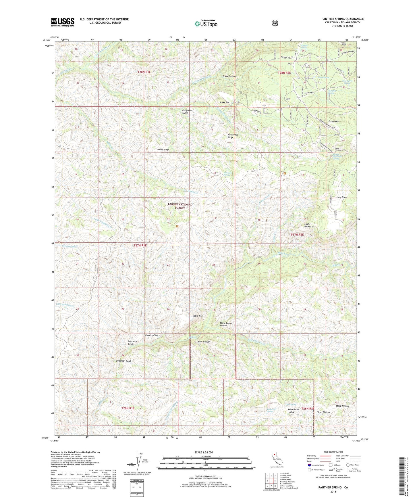
Panther Spring California US Topo Map
Couldn't load pickup availability
Also explore the Panther Spring Forest Service Topo of this same quad for updated USFS data
2022 topographic map quadrangle Panther Spring in the state of California. Scale: 1:24000. Based on the newly updated USGS 7.5' US Topo map series, this map is in the following counties: Tehama. The map contains contour data, water features, and other items you are used to seeing on USGS maps, but also has updated roads and other features. This is the next generation of topographic maps. Printed on high-quality waterproof paper with UV fade-resistant inks.
Quads adjacent to this one:
West: Dewitt Peak
Northwest: Inskip Hill
North: Finley Butte
Northeast: Lyonsville
East: Barkley Mountain
Southeast: Devils Parade Ground
South: Deer Creek Flat
Southwest: Acorn Hollow
This map covers the same area as the classic USGS quad with code o40121b7.
Contains the following named places: Avery Creek, Avery Place, Bear Canyon, Black Oak Grove, Blunkall Crossing, Boat Gunwale Creek, Buckhorn Gulch, Bucks Flat, Cave Spring, Cedar Crossing, Crazy Canyon, Davison Spring, Deadman Gulch, East Tehama Division, Emigrant Spring, Horseback Ridge, Indian Ridge, Kingsley Cove, Knass Spring, Little Bucks Flat, Long Point, North Fork Antelope Creek, Panther Spring, Panther Spring Guard Station, Pape Place, Payne Spring Cabin, Peligreen Gulch, Peligreen Place, Rancheria Creek, Round Mountain, Round Mountain Creek, Round Mountain Spring, South Fork Antelope Creek, Steep Hollow, Stone Corral Hollow, Table Mountain, Tail Holt Spring, Two-Barrel Spring, Wild Horse Corral