MyTopo
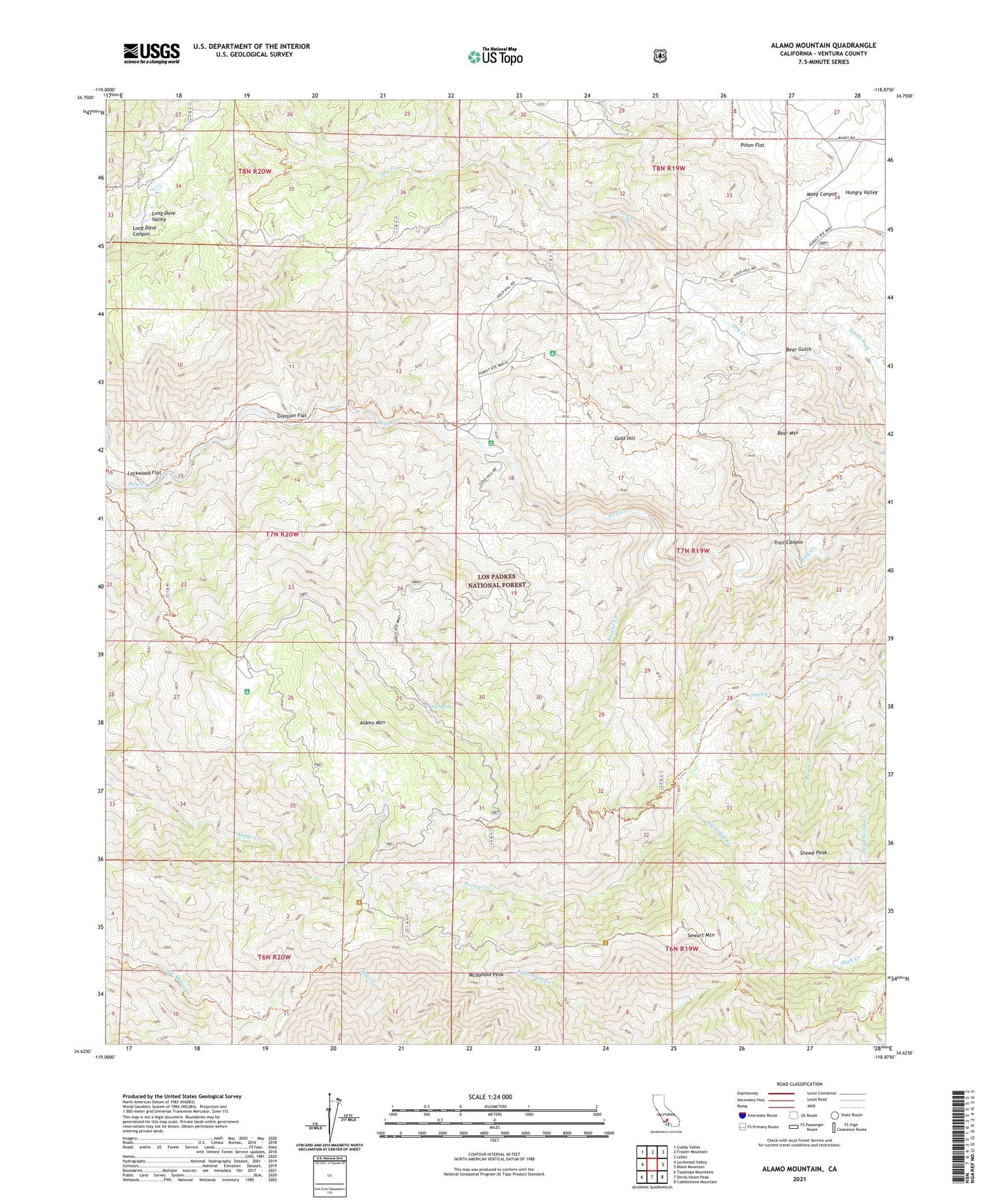
Alamo Mountain California US Topo Map
Couldn't load pickup availability
Also explore the Alamo Mountain Forest Service Topo of this same quad for updated USFS data
2021 topographic map quadrangle Alamo Mountain in the state of California. Scale: 1:24000. Based on the newly updated USGS 7.5' US Topo map series, this map is in the following counties: Ventura. The map contains contour data, water features, and other items you are used to seeing on USGS maps, but also has updated roads and other features. This is the next generation of topographic maps. Printed on high-quality waterproof paper with UV fade-resistant inks.
Quads adjacent to this one:
West: Lockwood Valley
Northwest: Cuddy Valley
North: Frazier Mountain
Northeast: Lebec
East: Black Mountain
Southeast: Cobblestone Mountain
South: Devils Heart Peak
Southwest: Topatopa Mountains
This map covers the same area as the classic USGS quad with code o34118f8.
Contains the following named places: Alamo Camp, Alamo Mountain, Baker Cabin, Bear Mountain, Big Cedar Creek, Big Spring, Big Springs Guard Station, Castaic Mine, Dead Horse Creek, Divide Forest Camp, Dutchman Campground, Dutchman Campsite, Dutchmans Camp, Frazier Creek, Gleason Flat, Gold Hill, Gold Hill Administrative Site Campground, Gold Hill Campground, Gold Hill Campsite, Gold Hill Guard Station, Harris Mill, Harris Mine, Henderson Trail, Kings Campsite, Lexington, Little Mutau Campground, Lockwood Creek, Lockwood Flat, Long Dave Valley, Maxy Canyon, McDonald Peak, Miller Trail, Pinon Flat, Rose Creek, Schmidt Ranch, Seven Pines Campsite, Sewart Mountain, Snowy Creek Trail, Snowy Forest Camp, Snowy Peak, Sunset Campground, Tatavium Cultural Preserve, Trail Canyon, Twin Pines Campground