MyTopo
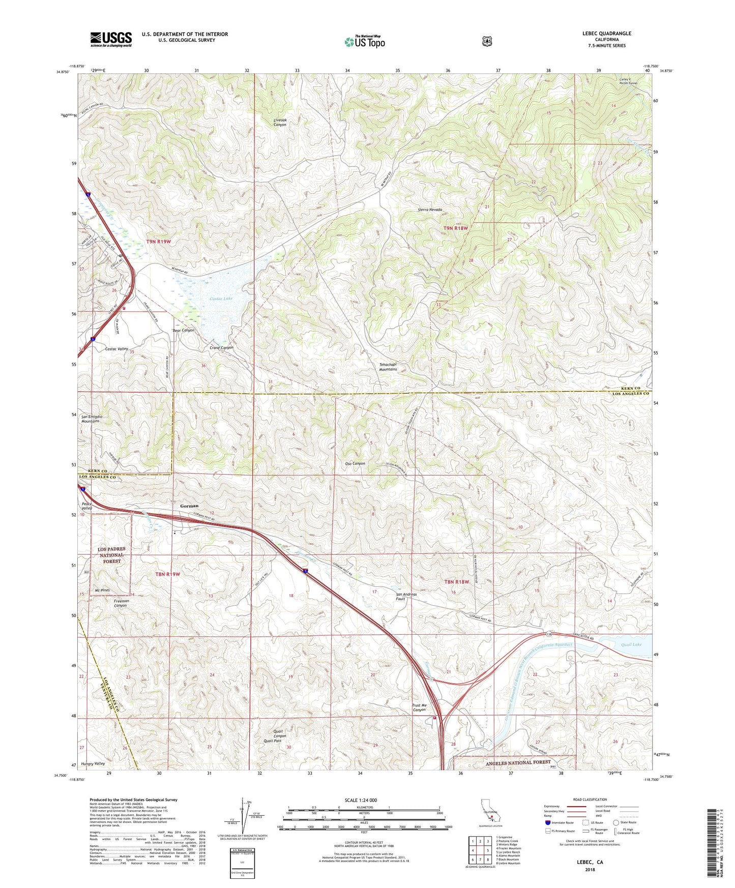
Lebec California US Topo Map
Couldn't load pickup availability
Also explore the Lebec Forest Service Topo of this same quad for updated USFS data
2022 topographic map quadrangle Lebec in the state of California. Scale: 1:24000. Based on the newly updated USGS 7.5' US Topo map series, this map is in the following counties: Los Angeles, Kern, Ventura. The map contains contour data, water features, and other items you are used to seeing on USGS maps, but also has updated roads and other features. This is the next generation of topographic maps. Printed on high-quality waterproof paper with UV fade-resistant inks.
Quads adjacent to this one:
West: Frazier Mountain
Northwest: Grapevine
North: Pastoria Creek
Northeast: Winters Ridge
East: La Liebre Ranch
Southeast: Liebre Mountain
South: Black Mountain
Southwest: Alamo Mountain
This map covers the same area as the classic USGS quad with code o34118g7.
Contains the following named places: 109 Limestone Quarry, 93243, Bailey Substation, Bear Canyon, Castac Lake, Cement Rock Quarry, Circle Canyon Campground, Crane Canyon, Freeman Canyon Cultural Preserve, Freeman Overlook, Gorman, Gorman Cultural Preserve, Gorman Elementary School, Gorman Substation, Holland Summit, Hungry Valley State Vehicular Recreation Area, Kern County Fire Department Station 56 Lebec, Lebec, Lebec Post Office, Los Angeles County Fire Department Station 77, Lower Quail Canal, Mount Pines, Old Bailey Ranch, Quail Lake Inn, Quail Lake School, Quail Pass, Redtail Canyon Campground, Sky Ranch, Tejon Guard Station, Tejon Lookout, Trust Me Canyon, Vortog Radio Navigation Station