MyTopo
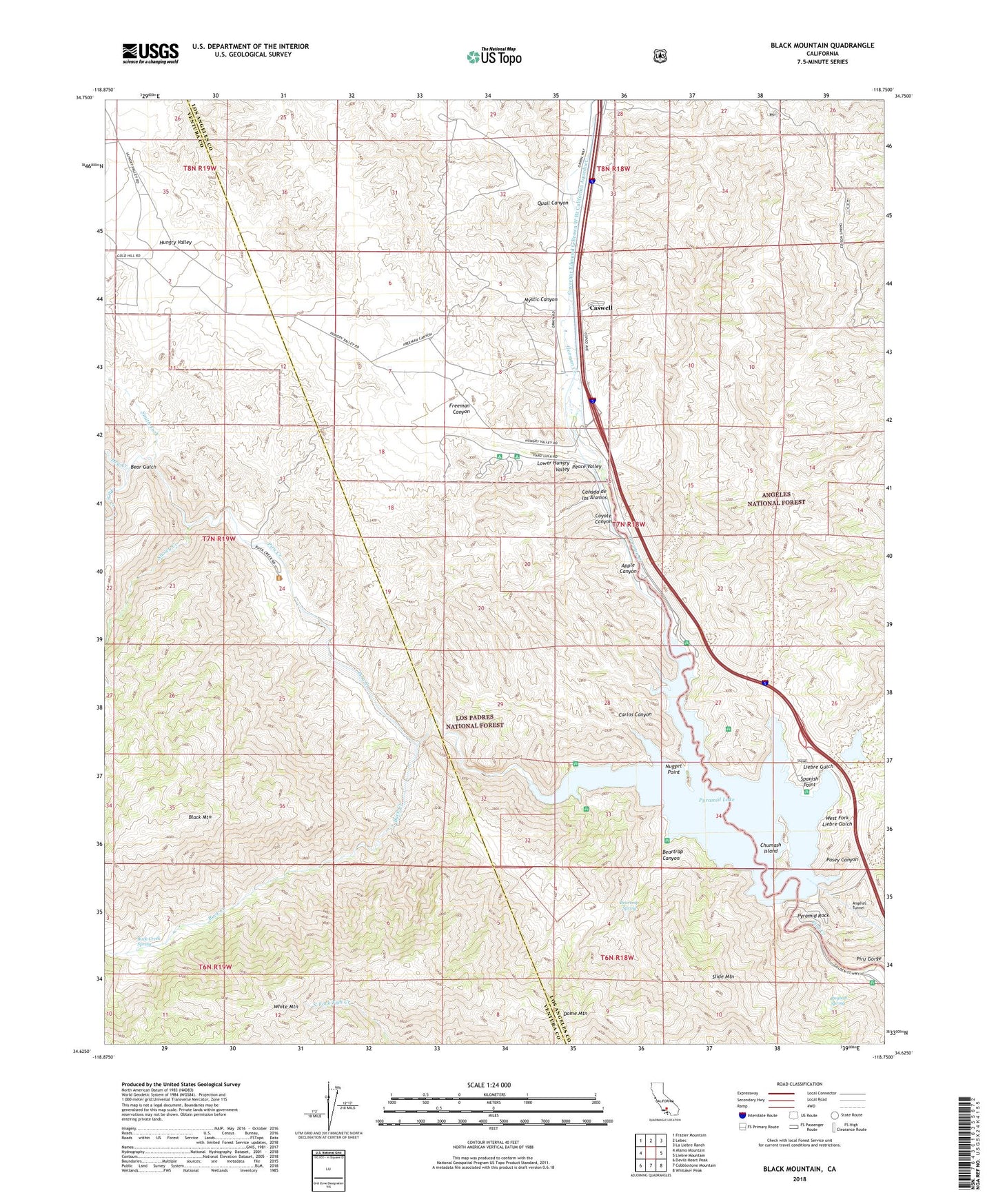
Black Mountain California US Topo Map
Couldn't load pickup availability
Also explore the Black Mountain Forest Service Topo of this same quad for updated USFS data
2022 topographic map quadrangle Black Mountain in the state of California. Scale: 1:24000. Based on the newly updated USGS 7.5' US Topo map series, this map is in the following counties: Los Angeles, Ventura. The map contains contour data, water features, and other items you are used to seeing on USGS maps, but also has updated roads and other features. This is the next generation of topographic maps. Printed on high-quality waterproof paper with UV fade-resistant inks.
Quads adjacent to this one:
West: Alamo Mountain
Northwest: Frazier Mountain
North: Lebec
Northeast: La Liebre Ranch
East: Liebre Mountain
Southeast: Whitaker Peak
South: Cobblestone Mountain
Southwest: Devils Heart Peak
This map covers the same area as the classic USGS quad with code o34118f7.
Contains the following named places: Alamo Ranch, Apple Canyon, Bailey Homestead, Bailey Trail, Bear Gulch, Beartrap Canyon, Beartrap Picnic Area, Beartrap Spring, Black Mountain, Buck Creek, Buck Creek Campsite, Buck Creek Guard Station, Buck Creek Spring, Buck Creek Trail, Canada de los Alamos, Carlos Canyon, Caswell, Chumash Island, Coyote Canyon, Dome Mountain, Dry Creek, Emigrant Landing, Emigrant Landing Picnic Area, Freeman Canyon, Glory Hole, Gorman Creek, Gorman Creek Siphon, Governor Edmund G Brown West Branch California Aqueduct, Hardluck Campground, Hungry Valley, Hungry Valley Siphon, Kinsey Ranch, Lane Ranch, Liebre Gulch, Liebre Gulch Maintenance Station, Liebre Pumping Station, Los Alamos Campground, Los Alamos Recreation Site, Lost Mine, Lower Hungry Valley, Mystic Canyon, Nugget Point, Peace Valley, Peace Valley Pipeline, Piru Gorge, Piru Guard Station, Posey Canyon, Priest, Pyramid 1-066 Dam, Pyramid Lake, Pyramid Rock, Quail Canyon, Quail Canyon Campground, Ridge Tavern, Royball Spring, Serrano Picnic Area, Side Hill Siphon, Slide Mountain, Slide Mountain Lookout, Smith Fork, Smith Fork Guard Station, Snowy Creek, Spanish Point, Tin Cup Picnic Area, Vaquero Picnic Area, West Fork Liebre Gulch, White Mountain, William E Warne Power Plant, Yellow Bar Picnic Area