
MyTopo
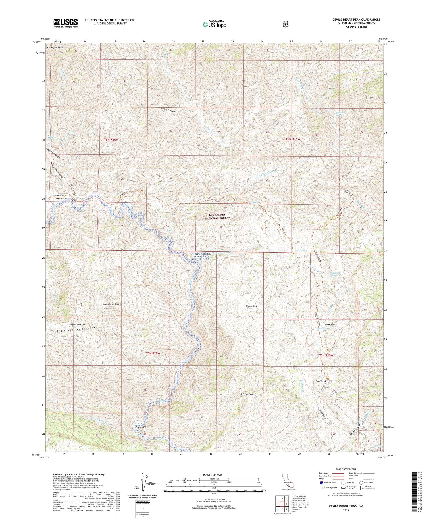
Devils Heart Peak California US Topo Map
Couldn't load pickup availability
Also explore the Devils Heart Peak Forest Service Topo of this same quad for updated USFS data
2023 topographic map quadrangle Devils Heart Peak in the state of California. Scale: 1:24000. Based on the newly updated USGS 7.5' US Topo map series, this map is in the following counties: Ventura. The map contains contour data, water features, and other items you are used to seeing on USGS maps, but also has updated roads and other features. This is the next generation of topographic maps. Printed on high-quality waterproof paper with UV fade-resistant inks.
Quads adjacent to this one:
West: Topatopa Mountains
Northwest: Lockwood Valley
North: Alamo Mountain
Northeast: Black Mountain
East: Cobblestone Mountain
Southeast: Piru
South: Fillmore
Southwest: Santa Paula Peak
This map covers the same area as the classic USGS quad with code o34118e8.
Contains the following named places: Alder Creek, Alder Creek Camp, Alder Creek Trail, Ant Campsite, Ant Rustic Campsite, Borracho Spring, Bucksnort Spring, Bucksnort Trail, Coldwater Fork, Coltrell Flat Camp, Condor Observation Site, Cottriel Flat, Cow Spring, Cow Springs Campground, Devils Heart Peak, Dough Flat, Dough Flat Observation Site, Dripping Springs, East Fork Alder Creek, Grassy Flat, Hot Springs Canyon, McDonald Cabin, McDonald Camp, Pigeon Flat, Redrock Creek, Saddle Skirt Rustic Campsite, Sespe Condor Sanctuary, Sespe Hot Springs, Shady Camp, Squaw Creek, Squaw Flat, Squaw Spring, Stone Corral, Stone Corral Creek, Sulphur Peak, Sycamore Canyon, Topatopa Peak, Twilight Mine, Upper Sespe River Trail, West Fork Sespe Creek


