MyTopo
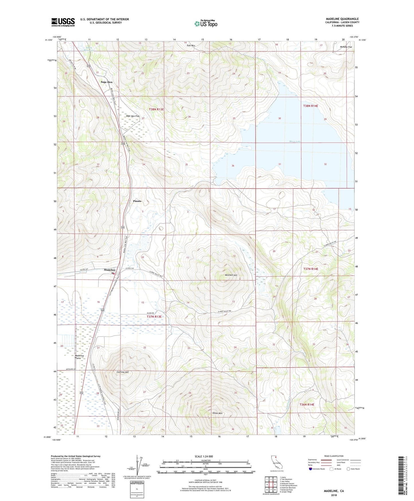
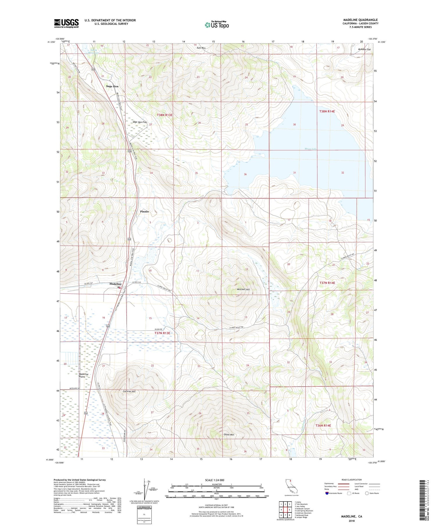
Madeline California US Topo Map
Couldn't load pickup availability
2021 topographic map quadrangle Madeline in the state of California. Scale: 1:24000. Based on the newly updated USGS 7.5' US Topo map series, this map is in the following counties: Lassen. The map contains contour data, water features, and other items you are used to seeing on USGS maps, but also has updated roads and other features. This is the next generation of topographic maps. Printed on high-quality waterproof paper with UV fade-resistant inks.
Quads adjacent to this one:
West: Holbrook Canyon
Northwest: Likely
North: Tule Mountain
Northeast: Jess Valley
East: Cold Spring Mountain
Southeast: Juniper Ridge
South: McDonald Peak
Southwest: Anderson Mountain
This map covers the same area as the classic USGS quad with code o41120a4.
Contains the following named places: Cochran Hill, Madeline, Madeline 1249-002 Dam, Madeline Census Designated Place, Madeline Fire Protection District, Madeline Post Office, Madeline School, Mitchell Field, Mitchell Hill, Moon Lake, Olson Mountain, Pinnio, Sage Hen, Sage Hen Flat, Smith Reservoir